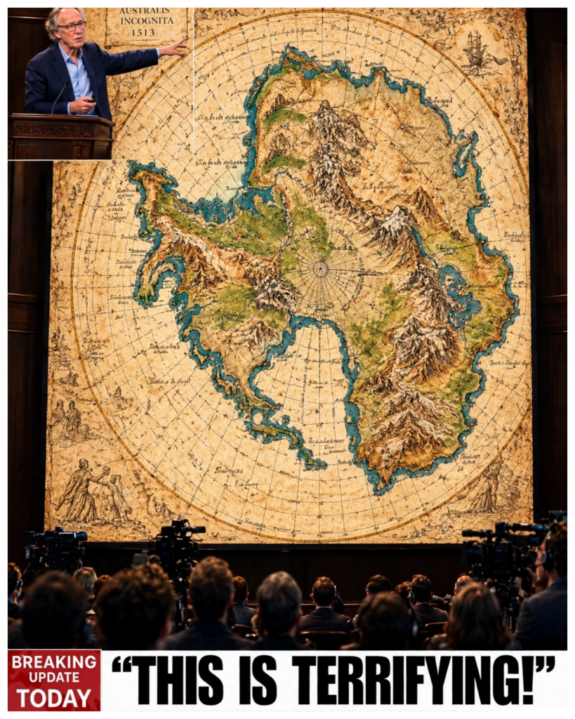
What if a map drawn over five hundred years ago showed a coastline that no human could have seen, one buried under miles of Antarctic ice?
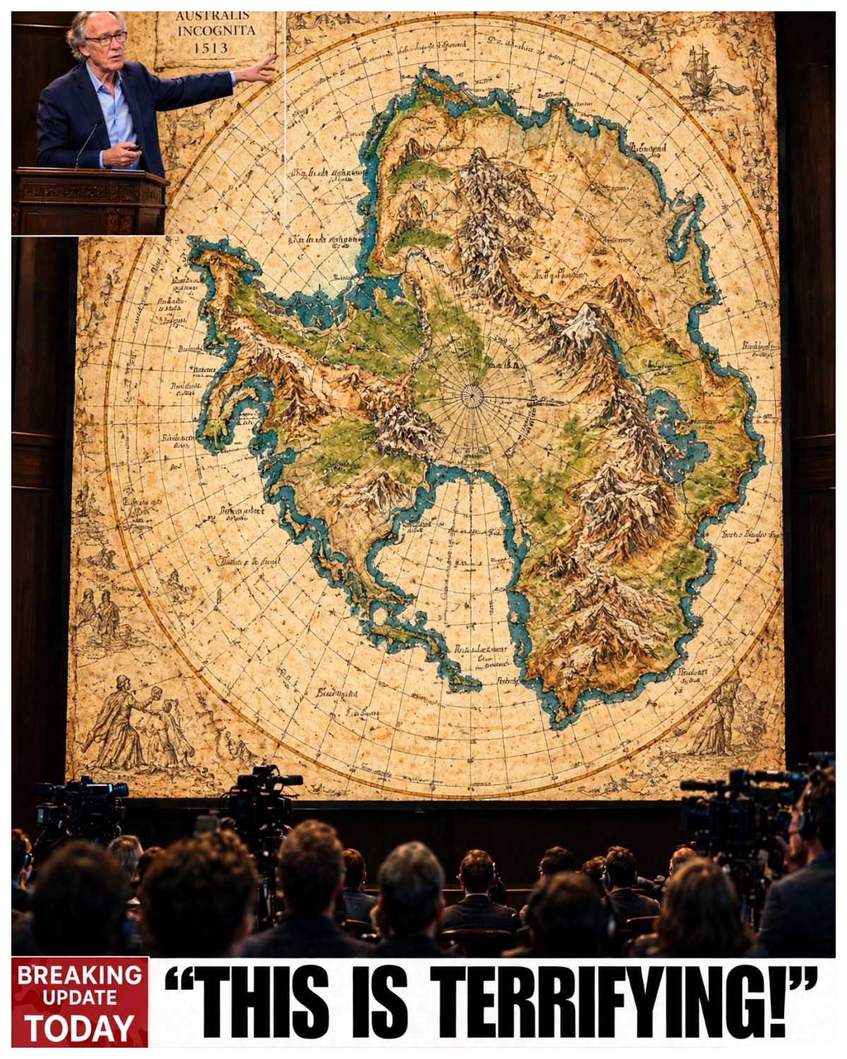
This idea has sparked wild theories about lost civilizations and ancient explorers with impossible knowledge.
But beneath the sensational headlines lies a story far richer and stranger.
How accurate was this map really?
Could it really depict Antarctica before it was covered in ice, or is there a more grounded explanation?
Join me as we unravel the truth behind one of history’s most debated cartographic mysteries.
The 1513 Ottoman Map’s Strange Coastline The fifteen thirteen Ottoman map, known as the Piri Reis map, is famous for its depiction of a mysterious southern coastline beneath South America, one that some claim shows Antarctica free of ice long before it was officially discovered.
This unusual coastline curves away from the continent and stretches beyond the edge of the parchment, sparking strong debate and fascination.
The line is peculiar because it does not match modern images of Antarctica’s ice-covered shores, leading some to suggest it shows land as it existed before the ice sheet formed.
The map itself is a fragment, roughly three feet by two, drawn on gazelle skin and richly detailed with ships, sea monsters, and Ottoman Turkish inscriptions.
Finding such an early piece of cartography with apparent knowledge of this hidden land raises major questions.
How could an early sixteenth-century cartographer depict a coast shielded by ice kilometers thick?
If humans never saw this coastline exposed, where did the information come from?
What fuels the mystery is the bold claim made in 1960 by U.S.
Air Force Lieutenant Colonel Harold Z.
Ohlmeyer.
While analyzing the map, he wrote to a history professor in New Hampshire, stating that the lower coastline segment on the map remarkably matches seismic surveys of the Antarctic landmass beneath the ice done years later in 1949.
According to him, this suggests the coastline was apparently mapped before it was hidden under ice, a statement that has inspired countless speculative theories about secret ancient knowledge.
Despite this intriguing claim, caution is essential.
The map does not explicitly say it shows Antarctica, nor does it present the shoreline seen in modern satellite images.
The idea that it reveals a lost civilization’s ice-free continent is widely contested by experts.
The map’s portrayal could be a combination of myth, guesswork, and the cartographic traditions of the time.
At the heart of this debate is the question of accuracy and interpretation.
Is this line a genuine representation of Antarctica, or is it an artifact of Renaissance mapmaking techniques and assumptions about the southern hemisphere?
The answer is complicated because the map serves multiple purposes: navigation, illustrating new discoveries, and incorporating older unknown data.
This southern coastline stretches smoothly beneath the continent’s outline, curving as if drawn from firsthand observation but standing apart from other known landmasses.
It creates an air of mystery, as if something significant is hidden in plain sight.
Understanding its true nature requires exploring who drew the map and how they gathered their information.
Many sensational stories feed on the allure of an ice-free Antarctica, suggesting ancient explorers or forgotten civilizations mapped it thousands of years ago.
But the truth, grounded in history and science, tends to be less dramatic yet more compelling, revealing about human knowledge, tradition, and the complexities of early cartography.
Before we reveal the science behind these claims, it is important to examine the person who created this fascinating map, the Ottoman admiral who gathered and compiled the information in the first place.
The Man Behind the Map, Piri Reis Piri Reis was an Ottoman admiral and cartographer born around 1470 into a naval family.
His uncle, Kemal Reis, was a famous privateer and naval commander who trained the young Piri in navigation and maritime warfare.
Rather than learning in classrooms, Piri absorbed his knowledge through real naval expeditions, battles, and firsthand experience on the seas.
This practical background made him a skilled seaman and mapmaker driven by a need for accurate nautical charts.
By the early fifteen-hundreds, Piri Reis had risen through the ranks to become an admiral overseeing naval operations in the eastern Mediterranean and later in the Persian Gulf.
In addition to commanding fleets, he compiled a detailed book called the Kitab-ı Bahriye, a comprehensive guide to ports, currents, and coastal geography valuable for Ottoman sailors.
The fifteen thirteen map was a result of Piri’s obsessive dedication to gathering geographic knowledge.
He drew it on gazelle skin and signed it himself, proudly listing the sources he used.
He credited around twenty older maps, including eight Ptolemaic charts, four contemporary Portuguese maps, Muslim and Indian sources, and even a map allegedly made by Christopher Columbus.
This detailed documentation shows that Piri Reis was not fabricating; he was synthesizing knowledge from various respected, albeit imperfect, sources.
Importantly, Piri’s map was not a scientific globe but a practical navigational chart.
It was designed with portolan style compass lines across the seas to aid sailors in plotting courses from one port to another.
There were no latitude or longitude grids, just compass bearings and coastal outlines intended for guidance at sea.
The southern coastline at the map’s bottom fits this navigation-focused purpose.
Piri’s life ended tragically in 1553 when, after commanding a failed campaign to expel the Portuguese near Hormuz, he fell from favor with the Ottoman governor of Basra.
He was executed by beheading in Cairo, a harsh end for a man who devoted his life to the empire’s naval dominance.
His map, however, survived centuries, locked away until its discovery.
The survival of the map reflects the importance of exploring not just the image itself but also the context of its creator, a driven admiral who pieced together the best geographic knowledge of his time.
It reveals that the map is less mystery of lost civilization and more a product of early modern cartographic practice blending fact and assumption.
Understanding where this piece of gazelle skin came from and how it resurfaced centuries later gives valuable insight into how this intriguing historical artifact became the center of a heated controversial debate.
The 1929 Discovery in Istanbul The story of Piri Reis’s map took a dramatic turn in 1929 when a fragment of the map surfaced during the conversion of Istanbul’s Topkapi Palace into a museum.
Amid clearing rooms for visitors, a wrapped bundle was found containing a damaged piece of gazelle skin.
This fragment, measuring roughly three feet by two, was already torn when discovered, representing only about a third of the original chart.
Halil Edhem, the museum director, quickly recognized the find’s potential significance.
Seeking expertise, he invited German orientalist and theologian Gustav Adolf Deissmann to examine the fragment.
Deissmann identified the map as a rare Ottoman navigational chart signed by the admiral Piri Reis, dated fifteen thirteen.
This confirmation ignited academic interest across Europe and the near East.
The preserved section contained a rich mix of artwork and writing: small sailing ships dotted across the seas, fanciful sea monsters populating dangerous waters, and Ottoman Turkish inscriptions along the margins.
These detailed illustrations reflect the artistic and practical values of early sixteenth-century mapmaking.
Most striking in the fragment was the almost flawless rendering of the western coasts of Europe and Africa, the Atlantic Ocean, portions of the Caribbean, and the eastern coastline of South America.
Remarkably, the coastline of South America had been charted with great accuracy, despite European contact with the continent being just over a decade old.
What makes this discovery even more impressive is that no latitude or longitude lines appear on the map.
Instead, it relies entirely on rhumb lines, compass directions drawn from multiple points across the seas, used by sailors to navigate between ports.
This utilitarian design shows the map’s intended function was purely navigational.
Since its discovery, scholars have debated the map’s sources and accuracy.
Piri Reis himself admitted compiling the chart from numerous older maps, including some Portuguese and possibly lost Greek charts.
This mix explains why certain parts, like the South American coast, were surprisingly up-to-date, while others, especially the enigmatic southern coastline, remain mysterious and problematic.
The map’s damaged condition means a significant portion remains missing.
Much speculation centers on what the complete original looked like and the details lost to time.
The surviving fragment, however, is invaluable in understanding early modern maritime exploration and the transmission of geographic knowledge.
This remarkable find in Istanbul connected a centuries-old Ottoman seafarer with modern cartographic challenges, setting the stage for the debates and investigations that followed decades later.
Beyond its immediate historical value, the discovery transformed a forgotten fragment into one of the most discussed maps in the world.
Researchers gained an opportunity to study how sailors gathered information, combined competing sources, and recorded new discoveries during an age of expanding maritime exploration.
Every inscription, coastline, and illustration offered another clue about the people who created and used the chart.
Although much of the original remains missing, the surviving portion continues to reveal connections between cultures and generations of navigators.
Its rediscovery proves that even damaged artifacts can reshape historical understanding and inspire questions that continue long after their recovery.
What followed next was a surprising link between this ancient map and twentieth-century military science, promising insight into whether the southern coastline really captured an ice-free Antarctica.
The 1960 Letter and Seismic Survey In 1960, a crucial piece was added to the puzzle of the Piri Reis map’s southern coastline.
Harold Z.
Ohlmeyer, a lieutenant colonel in the United States Air Force, specializing in aerial reconnaissance and map analysis, wrote a detailed letter to Charles Hapgood, a professor of history at Keene State College in New Hampshire.
Ohlmeyer pointed out a striking similarity between the lowermost coastline on the fifteen thirteen map and a seismic survey conducted in 1949 by a Swedish-British scientific expedition across Antarctica’s ice-covered landmass.
This coincidence was unexpected and intriguing.
The letter stated that these geographic details, invisible to anyone on the surface due to the thick ice sheet, seemed to match remarkably well.
Ohlmeyer explained that the map appeared to represent the continent’s shape before the ice had covered it, a coastline no living person could have observed first-hand.
This assertion fueled speculation that the map might be based on extremely ancient sources or lost knowledge, giving rise to the theory that an ice-free Antarctica once existed within human memory.
While the letter’s suggestion was compelling, it was by no means definitive proof.
The seismic data itself relies on underground echoes and vibrations to reveal landforms beneath the layer of ice, not direct visual confirmation.
Moreover, modern science has shown Antarctica has been ice-covered for millions of years.
Yet the mere possibility that a centuries-old map could unveil such hidden information presented a tantalizing mystery.
This connection also gave the Piri Reis map a new lease on life in scholarly and popular debates.
Here was a formal statement from a trained military officer, versed in interpreting aerial and geophysical data, lending authority to a centuries-old artifact.
For more than sixty years, this letter has been frequently cited as evidence for speculative narratives that ancient civilizations mapped Antarctica before the ice sheet formed.
Yet the letter alone doesn’t settle the question.
It speaks to a comparison between two shapes, underscored by admiration for their similarity, but it is not an exhaustive scientific study.
Ohlmeyer himself did not venture into grand claims but rather shared an informed observation, inviting others to investigate further.
The letter combined with the seismic map cast a shadow over the notion that the coastline depiction was mere guesswork or artistic imagination.
It suggested instead that the Ottoman map might have incorporated ancient geographic data predating modern understanding of Antarctica.
Ohlmeyer’s role brings a military and scientific lens to a subject often clouded by myth and conspiracy, a perspective sometimes lost in popular retellings.
It urges a sober reconsideration rather than sensational conclusions, pending further evidence.
Ultimately, the significance of Ohlmeyer’s letter lies in the questions it raised and the debate it continues to inspire.
A resemblance between two coastlines may justify further investigation, but it cannot independently establish the origin or age of the information behind a historical map.
Researchers must consider projection errors, geographic distortions, and the limitations of both historical charts and modern surveys.
By examining these factors together, historians can distinguish intriguing coincidences from reliable conclusions.
The Piri Reis map remains a valuable window into early cartography, demonstrating how a single observation can spark decades of discussion about the boundaries between historical knowledge and speculation.
But the story doesn’t stop there; it grew even more complex with the involvement of Charles Hapgood, Albert Einstein, and a controversial geological theory unfolding in the mid-twentieth century.
Charles Hapgood, Einstein, and Controversy Charles Hapgood was a history professor with a bold and controversial scientific idea: that the Earth’s crust could shift dramatically, displacing continents much more rapidly than traditional plate tectonics would suggest.
In 1958, he published The Earth’s Shifting Crust, proposing that these crustal displacements could explain puzzling geological phenomena and ancient myths.
Hapgood’s theory suggested that Antarctica might once have been ice-free, located differently on the globe.
Hapgood’s work caught the attention of Albert Einstein, who responded cautiously.
In May 1953, Hapgood sent Einstein nearly forty pages of evidence supporting his ideas, and Einstein replied with high praise for the hypothesis’s creativity and potential importance.
However, Einstein was careful to clarify that he merely believed the topic deserved serious investigation and did not fully endorse all Hapgood’s conclusions.
Tragically, Einstein passed away in 1955, well before Hapgood’s Antarctic maps theory became widely publicized.
After Einstein’s death, Hapgood elaborated his ideas further, including controversial claims that ancient maps like those of Piri Reis preserve knowledge of a shifting Earth’s crust, showing continents as they were before massive ice accumulations.
His 1966 book Maps of the Ancient Sea Kings popularized the idea that early cartographers may have accessed secret or ancient knowledge of Antarctica’s ice-free coastline.
Hapgood’s theory attracted supporters intrigued by the idea of a lost prehistoric civilization with advanced geographical understanding.
However, mainstream geology and archaeology largely rejected the hypothesis, citing lack of direct evidence and the implausibility of such rapid crustal shifts.
Still, Hapgood’s ideas fueled many alternative theories and inspired researchers and storytellers fascinated by ancient mysteries.
The controversy extended beyond science; it became cultural, intertwining with narratives promoted by authors like Graham Hancock, who argued for ancient global civilizations erased by cataclysms.
The Piri Reis map was central to such arguments, used as “proof” of lost civilizations and forgotten episodes in human history.
Despite the excitement, Hapgood’s connection with Einstein was often exaggerated or misunderstood.
No direct endorsement of Antarctica map claims came from Einstein, and the association is sometimes used more as persuasive weight than factual support.
This subtle but important distinction is often overlooked in popular interpretations.
The debate raised fundamental questions about how to read ancient maps, the reliability of early cartographic sources, and the boundary between legitimate historical inquiry and speculative storytelling.
Hapgood’s bold ideas highlighted the tensions between scientific caution and human fascination with mystery.
Yet, as dramatic as this hypothesis may sound, modern scientific evidence presents a different, clearer picture of Antarctica’s history, one that challenges the map’s initial interpretations and the grand theories built on them.
Ultimately, Hapgood’s legacy lies in the questions his theories raised rather than the conclusions they established.
His work demonstrates how a compelling hypothesis can capture public imagination even when scientific evidence remains insufficient.
The association with Einstein adds another layer to this story, reminding us that intellectual curiosity does not equal agreement.
When examining controversial historical claims, separating documented facts from later interpretations becomes essential.
The Piri Reis map remains an extraordinary artifact, but its true significance emerges through careful research, not dramatic assumptions.
By questioning bold theories while respecting historical evidence, we gain a clearer understanding of both the map and the debates surrounding it.
The tale of Piri Reis’s map moves next from lofty conjectures about crustal shifts to grounded geological realities and the stories hidden within Antarctic ice itself.
Modern Science and Antarctic Ice Ages The mystery of the Piri Reis map takes a crucial turn when we look at what modern science tells us about Antarctica’s ice cover.
Geological evidence shows that Antarctica has been covered by ice for tens of millions of years, far longer than the few thousand years some theories suggest.
The main glaciation began about thirty-four million years ago during the Eocene-Oligocene transition, one of the most significant climate shifts in Earth’s history.
This extended ice coverage is supported by extensive data from ice cores, sediment samples, and fossils.
Deep beneath the Antarctic ice sheet, scientists have found fossils of ancient forests and plants, indicating the continent was once green and warm.
But this lush, ice-free environment existed long before humans or any advanced civilization could have mapped it.
Radar surveys have revealed entire buried landscapes under the thick ice, including ancient river systems and valleys etched into the bedrock.
These hidden terrains offer a detailed record of how Antarctica has changed over millions of years, confirming that the current ice sheets are not a recent development.
It becomes clear that no human could have witnessed or mapped an ice-free Antarctic coastline within recorded history.
The timeline of human evolution also invalidates the idea that prehistoric people charted Antarctica’s coast.
Modern Homo sapiens have existed for only a few hundred thousand years, while early ancestors date back a couple of million years.
These timescales are minuscule next to Antarctica’s long ice age, making the possibility of accurate ice-free mapping by ancient civilizations virtually impossible.
In addition, the geological processes that shaped this ice cover, including atmospheric carbon dioxide changes and ocean circulation shifts, happened gradually over millions of years.
The ice didn’t appear suddenly but developed over a vast timespan, further negating the chances that an ice-free coast could have been observed in recent human history.
Understanding that the Piri Reis map does not accurately depict an ice-free Antarctica means having to disregard scientific evidence, which isn’t something one should be expected to do.
What researchers find in the map, and indeed most analyses, are not in line with an actual past wherein Antarctica was free of ice.
Rather, alternative explanations should be looked at.
These findings illuminate the need to base the investigation of unexplained occurrences on sound scientific research.
There may be room for imagination, as with all studies that look into the unexplained, but one should keep in mind that the findings under the ice in Antarctica supersede the imagination.
While researchers uncover evidence related to paleoclimatology, they are discovering things that took place on earth long before the dawn of human civilization.
These ancient discoveries raise more interesting questions, and one among them is why, after such an incredible level of understanding of geography was supposedly lost in the dark ages, the ancient map makers were still able to produce charts of a much greater level of accuracy.
It was, after all, the same imagination, inherited traditions, and fragmented observation.
To understand the map fully, we should look at how early cartographers imagined the southern hemisphere, often as a massive, unknown landmass called Terra Australis.
The “Terra Australis” Tradition and Cartography For centuries before Antarctica was officially discovered, European mapmakers believed in the existence of a great southern continent called Terra Australis Incognita, “Unknown Southern Land.”
This theoretical landmass appeared on many maps from the Renaissance and earlier and served as a balancing counterpart to the northern continents.
Cartographers placed it at the bottom of their maps, often stretching it across the southern oceans.
These maps were not based on firsthand exploration but speculation, classical texts, and the desire for a symmetrical world.
Terra Australis was drawn with varying shapes and extents, sometimes as a vast continent, other times as a fragmented archipelago.
It was an accepted part of geographic thought, a placeholder for unknown lands that balanced the known world.
Piri Reis’s map fits within this context.
The extended, curving southern coastline portrayed beneath South America corresponds closely to the Terra Australis tradition.
Scholars such as Gregory McIntosh have shown that the map’s southern landmass isn’t Antarctica as we understand it today but rather a Renaissance-era representation merging known coastlines with the imagined southern continent.
This understanding explains many anomalies.
The coastline is a distorted continuation of South America blended with these speculative southern lands.
The map’s lack of consistent latitude and longitude grids also contributes to the distortion; it relies on compass bearings over a flat surface, stretching and twisting the geography to fit available space.
The Piri Reis map reflects the best available knowledge and myths of its time, combining recent discoveries like parts of the Americas with inherited geographic ideas like Terra Australis.
It was a practical navigational tool as well as a document illustrating the geographic imagination of the age.
This explains why the southern coastline looks like it does, not a frozen Antarctic reality, but a blend of observation, assumption, and cartographic convention.
It also helps clarify why modern satellite analysis does not confirm the map as a literal depiction of ice-free Antarctica.
The idea of the great Southern land (Terra Australis) has shaped the imaginations of cartographers and explorers, and intrigued generations of scientists with the real possibility of an unmapped, uncharted continent of the Antarctic.
The boundary between speculative geography and modern cartography became apparent once the southern land was first encountered and then mapped.
It is the early traditions of the craft of cartography which are the key to understanding why some early cartographers included a land of uncertain form and shape in the southern latitudes.
It is the key to appreciating why certain early maps contained cartographically problematic and geographically inexplicable features.
Rather than losing their mystery, these features became more fascinating in their understanding of the traditions of the transmission of geographical knowledge and the art of cartography.
With that understanding, we go beyond looking for missing civilizations to understand cartography as a sophisticated art form that reinterprets and records the world around us.
With its focus on understanding what early cartographers got right and wrong, the Terra Australis traditions tell a richer story of why people once believed in and documented a world they could not possibly know.
Imagination has been and continues to be the only substitute for the unknown.
Early cartographers relied on limited information, tradition, and reports of sailors who visited lands farther than any of them had.
The maps they made were an honest attempt at understanding an unknown world.
One of the great curiosities in history is the Piri Reis Map.
Though we see fragments that we believe represent a lost civilization, when viewed in its historical context, it actually chronicles the development of geography from the theoretical to the scientific.
In particular, the southern coastline.
This glimpse into ancient beliefs and mapmaking traditions leads us next to the ongoing mysteries that even expert cartographers admit remain unsolved.
The Lasting Mystery and Map’s True Significance Even after centuries of study, the Piri Reis map continues to hold mysteries that experts still find puzzling.
One of the most striking aspects is how such an accurate and detailed navigational chart appeared suddenly in the early sixteenth century, without clear predecessors or drafts.
This sudden emergence highlights a gap in the historical record, a missing link between earlier, less precise maps and the refined portolan charts like Piri’s.
Historians of cartography acknowledge that the portolan style of mapmaking, characterized by precise coastlines and a network of compass lines, appeared fully formed in the late thirteenth century.
The earliest surviving example, the Carta Pisana, dates to around 1290 and already demonstrates remarkable accuracy, especially for the Mediterranean Sea.
This suggests a long, undocumented tradition of map refinement, likely based on the accumulated knowledge of generations of seafarers.
The absence of earlier, rough or incomplete drafts before these portolan maps continues to intrigue scholars.
How did mapmakers develop such detailed and consistent charts so rapidly?
The Piri Reis map, with its sophisticated assembly of over twenty source maps, some dating back to antiquity, reflects this deep but mostly invisible tradition of knowledge transmission.
This underlying mystery shifts the focus from mythical lost civilizations to the resilience and longevity of practical human knowledge.
The maps survived not because of secret archives or sudden rediscoveries but through repeated copying, updating, and refining over centuries by skilled navigators and scholars.
The enduring survival of Ptolemaic coordinates, navigational notes, and empirical data shows how knowledge evolves and persists beyond singular creators or cultures.
On the other hand, the map’s southern coastline remains a tantalizing enigma.
If it doesn’t depict an ice-free Antarctica, what is it?
Scholars suggest it is most likely an imaginative extension based on the concept of Terra Australis, an assumed balancing southern continent, combined with distortions inherent to early mapping techniques.
This blend of fact, assumption, and artistic representation created a coastline that, while striking, is not a literal geographic record.
The larger lesson here is how human understanding is built amid uncertainty.
Even extraordinary claims must be tempered by scientific evidence and historical context.
The Piri Reis map teaches us that history, science, and mythology often intertwine, challenging us to separate evidence from speculation without losing a sense of wonder.
Moreover, the survival of this map fragment and the complexity uncovered by modern research underscore the humility required in interpreting artifacts from distant eras.
Each piece adds to a larger mosaic of human history, where some questions remain open and some mysteries deepen as we learn more.
As the Piri Reis Map is a treasure trove of information, it is easy to view as only an outlier.
However, this interpretation lacks depth as it completely misses the Map’s historical significance.
It is a perfect example of a phenomenon.
Its mystery represents a point of intrigue and an opportunity to explore the curiosity that drives the development of human knowledge throughout time.
Future iterations of maps should follow the example set by the Piri Reis map and include lessons to prompt additional, grounded, evidence-based study of the topic.
An additional, and often necessary, consideration of a map’s creation, use and impact is a healthy dose of humility regarding our place in a larger human experience that is always unfolding.
In other words, one shouldn’t assume to know what it is they are observing.
Researchers, however, are constantly evolving their techniques.
With time and progress in this regard, new perspectives on historical events, even old knowledge in new light, could shed new light on the distribution of old knowledge in space and time.
There will still be uncertainty, and that’s okay, maybe that’s why it is intriguing.
Maybe history will never be closed.
It is an evolving process where the evidence determines our hypotheses and we continue the research for curiosity’s sake.
The Piri Reis map invites us to appreciate the blend of fact, myth, and tradition that shapes our view of the past.
If you enjoyed unraveling this puzzle with me, please like and subscribe for more deep dives into history’s greatest mysteries.
Your support helps keep the search for truth alive.