About 4 miles from a mountain called Jabal al-Lawz in northwest Saudi Arabia, there’s a field of ancient stone graves.
Some researchers believe 3,000 Israelites were buried there, the ones who died after the golden calf.
They told us not to look.
For decades the mountain sat behind a fence, guard posts, and warning signs, while the official story sent every pilgrim to a different peak in Egypt.
A small group of explorers kept insisting the real Mount Sinai was here in Saudi Arabia.
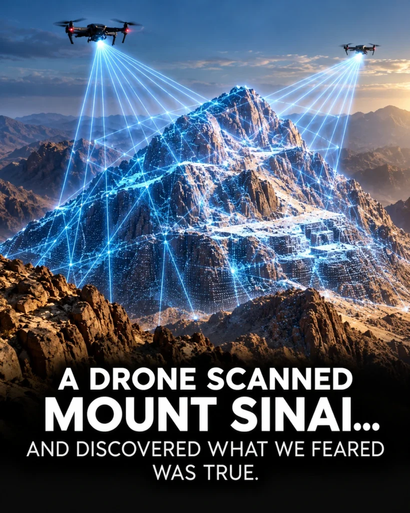
So, what was that fence protecting? In 2025, a claim started spreading that a drone had flown over the mountain with radar that could see beneath solid rock.
The people sharing it say the scan picked up rectangular chambers and grid-like rooms, shapes erosion doesn’t usually make.
Could that be a coincidence? According to Exodus, this is where Moses stood before God and received the Ten Commandments.
If the scan is real, it could be the first physical evidence of the Exodus, and it would confirm what some believers have feared for 1,500 years.
Pilgrims have been climbing the wrong mountain.
So, let’s open the story behind that fence and see what holds up.
I’m Ambrose Wilde, and the first surprise in this story has nothing to do with drones.
It’s how young the famous Mount Sinai in Egypt really is.
Part 1.
The mountain the monks chose.
On the southern tip of Egypt’s Sinai Peninsula, a granite peak called Jabal Musa rises about 2,285 m above a desert valley.
Every night hikers with headlamps climb it to watch the sunrise from the summit, and the steepest route takes them up roughly 3,750 stone steps cut by monks.
At the bottom sits St.
Catherine’s Monastery with walls thick enough to pass for a fortress.
Built on the orders of the Byzantine Emperor Justinian in the 500s, it holds one of the oldest working libraries on Earth.
In the 1800s, a German scholar found pages there from one of the oldest surviving Bibles ever discovered.
So, the place has real history.
The trouble is how far back that history goes.
The earliest detailed account we have of anyone treating Jebel Musa as the mountain of Moses comes from a pilgrim named Egeria, a woman from Western Europe who traveled there around the year 383 and kept a diary.
Monks led her up the peak, and back in the valley they showed her a bush they said was the burning bush.
But, her diary was written roughly 1,000 600 to 1,800 years after the dates usually proposed for the Exodus.
And nothing much older ties Moses to this peak.
That gap is the first sign that the fear in this video’s title might be justified.
And the Bible’s own clues keep pulling the story east.
Exodus says Moses found the mountain of God while he was tending sheep for his father-in-law, Jethro, a priest of Midian.
Midian, according to ancient geographers and modern archaeologists alike, sat east of the Gulf of Aqaba in what is now northwest Saudi Arabia.
There’s even an oasis town there called Al Bad, where cliff tombs carved by later Nabataean builders are still known locally as the caves of Shuaib.
That’s the name Islamic tradition gives to the prophet sent to Midian, a figure many Muslims link with Jethro.
Then, there’s a line in the New Testament that people tend to skip.
In his letter to the Galatians, the Apostle Paul mentions Mount Sinai in Arabia, and Exodus 19 describes the mountain in a way that sounds almost geological.
Smoke rises like smoke from a furnace and the whole mountain shakes violently.
Jabal Musa is ancient granite and nobody has found any trace of volcanic activity there.
None of these clues is a knockout on its own and every one of them has a counter argument we’ll get to.
But put them together and you can see why as early as the 1870s a British explorer was already arguing that the real Sinai stood east of the Gulf of Aqaba.
For over a century though, nobody could go and check.
Then in 1984 an American amateur archaeologist crossed into Saudi Arabia without permission to do exactly that.
Part two.
The fence and the scan.
His name was Ron Wyatt and he went in with his two sons.
Saudi authorities caught them and held them for weeks reportedly on suspicion of spying before letting them go.
Four years later two more Americans, Bob Cornuke and Larry Williams, slipped in and came back with the photographs that turned this mountain into a legend.
They showed a summit capped in dark almost black rock, a stone platform surrounded by carvings, and long lines of stones running across the valley floor.
Those photos also captured the fence and according to the explorers and the visitors who came after them, the signs on it described the site as an archaeological area protected by the kingdom’s antiquities authorities with trespassers warned off.
So the honest answer to what that fence was protecting is less dramatic than the internet version.
The kingdom treated the area as a heritage site at a time when Saudi Arabia barely issued tourist visas at all.
That alone doesn’t prove a cover up, though it does tell you someone official thought there was something there worth guarding.
And since the country opened up to tourism in 2019, visitors have started posting their own photos from the area, which brings us to 2025 and the drone.
Here’s what the viral version claims.
A team flew a drone over Jabal al-Lawz carrying ground penetrating radar, and the scan revealed rectangular rooms and corridors buried under the mountain.
What’s missing is everything you’d need to check it.
I couldn’t find a named team, a named university, a permit announced by Saudi Arabia’s Heritage Commission, a published image, or a single raw data file.
Every version of the story traces back to videos and posts, each one citing the others.
The physics deserves a look, too.
Ground penetrating radar sends radio pulses into the ground and listens for echoes.
In ordinary soil, it usually reads only a few meters down.
In very dry rock with low-frequency equipment, it can sometimes reach tens of meters.
Mount the antenna on a drone, though, and part of the signal bounces off the surface before it ever gets into the ground.
That’s why in 2025, geophysicists at a university in Munich were still publishing studies just testing whether drone-mounted radar works for archaeology at all.
And that same year had already given us a test run for this exact kind of story.
That spring, a group of Italian researchers announced that radar data showed a vast network of shafts and chambers deep beneath the pyramids of Giza.
It went everywhere.
Egyptologists and other experts pushed back hard, pointing out that the work hadn’t been peer-reviewed, and that the technology couldn’t see structures at those depths.
So, right now, the scan in the headline is a claim without a source.
If real data ever appears, the first questions are simple.
Who flew it? With what equipment? And can anyone else look at the numbers? A real radar survey produces cross-section images called radar grams where buried edges and voids show up as stacked curves and researchers publish them so other specialists can argue over what they mean.
A claim that arrives with a dramatic description and no images has skipped the part everyone else gets to check.
But this is where the story gets more interesting.
Throw the scan out completely and the case for this mountain still stands up surprisingly well.
Some of the most striking evidence is sitting right on the surface and part of it points somewhere none of the explorers expected.
Part three, what the explorers found.
Start at the top with that dark summit.
Supporters say it looks scorched and they connect it to Exodus 19 where the Lord descends on the mountain in fire.
It’s a vivid image.
The catch is that no published lab study has shown that rock was ever altered by heat.
Dark rock sitting on top of lighter rock happens in plenty of mountain ranges because the layers formed at different times and in different ways.
The volcano idea is still worth a look though.
Northwest Arabia is covered in huge lava fields and some of them were active in recorded history.
In 1256 an eruption near Medina sent lava flowing to within a few miles of the city.
A Cambridge physicist named Colin Humphreys argued in a 2003 book that Exodus describes a real eruption and he pointed to a volcanic mountain in Arabia called Hala al-Badr.
So if you read Exodus 19 literally, the strongest candidate isn’t Jabal al-Lawz at all.
It’s a different Saudi mountain a couple of 100 km to the southeast.
Next, the split rock.
In the same region stands a tall boulder cracked straight down the middle perched on a small hill with weathering around its base that supporters read as the mark of flowing water.
They connect it to Exodus 17 where Moses strikes a rock at Horeb and water pours out for the people.
One detail most retellings drop is that Exodus places that miracle at Rephidim before the Israelites reach the mountain.
That fits a rock some distance away, which is a point in the supporters favor.
Geologists add a caution, >> [snorts] >> though, because desert boulders split all the time as rock heats in the day and cools at night.
And water marks need dating before they can be pinned to any event.
Then the altar.
Near the base of the mountain is a large heap of stacked stones, and on boulders nearby are carvings of cattle.
Some in a style supporters compare to the Apis bull worshipped in Egypt.
They link it to Exodus 32 and the golden calf.
And this is where newer research changes the picture.
Across northwest Arabia, archaeologists have now documented more than 1,000 strange stone structures called mustatils.
The name means rectangles in Arabic.
They’re long, low stone enclosures, some longer than a football pitch, and excavations have found cattle horns and skulls placed inside them as offerings.
They date to roughly 7,000 years ago, when this desert was greener and herders kept cattle.
Cattle are also among the most common images in Arabian rock art from those wetter periods.
Think about what that means for the whole legend.
Rectangular stone shapes and cattle worship turn up in this same part of Arabia thousands of years before any date anyone has proposed for Moses.
If you were looking for a source for stories about rectangles under the mountain and a calf cult at its foot, this is a strong one.
The stone lines across the valley, the ones supporters call the boundary markers from Exodus 19, sit in a region full of ancient stone lines built by people archaeologists are only starting to understand.
And the graves from the start of this video Exodus 32 does say about 3,000 men died after the golden calf, but northwest Arabia is one of the densest tomb regions anywhere.
And archaeologists surveying from the air have recorded tens of thousands of ancient stone burials across it.
Without excavation and dating, a cemetery near the mountain tells us that people lived and died here and nothing more.
So, the surface evidence is real and it really is old.
What nobody has shown yet is whose it is.
And the strongest objection to the whole Exodus story comes from the people who should have left traces everywhere.
Part four.
The case against Exodus 12 says about 600,000 men left Egypt on foot, not counting women and children.
Add families and you’re past 2 million people, roughly the population of Paris, camped in the desert for nearly a year, then wandering for 40.
Skeptics say a crowd that size should leave a mark, and they have a point you don’t usually hear.
The archaeologist Israel Finkelstein and the historian Neil Asher Silberman wrote in a 2001 book that surveys in Sinai have picked up the faint remains of small nomadic camps from other eras, including the third millennium BC and later Greek and Byzantine times.
So, archaeologists can find tent camps in this desert and none so far comes from the right period.
At Kadesh Barnea, where the Bible says the Israelites spent much of their wandering, digs found an Iron Age fortress and little that fits the late Bronze Age.
Defenders have two answers.
The first is that we’ve been searching the wrong desert and Arabia has barely been surveyed by comparison.
That’s fair.
And it’s the strongest practical argument for digging at Jabal al-Lawz.
The second answer is about the numbers themselves.
The Hebrew word translated as thousand, aleph, can also mean a clan or a military unit.
Humphreys used that reading to argue the real group may have been closer to 20,000 people.
A group that size could leave very little behind.
The geographic clues from part one get pushed back, too.
In Paul’s day, the word Arabia covered the Nabataean kingdom, which reached into parts of the Sinai Peninsula.
So, his line doesn’t settle anything.
And Exodus 18 says that after Jethro visited Moses at the mountain, he went back to his own land.
Critics read that as a hint the mountain stood outside Midian, while supporters answer that Midian was a big place.
Then there’s Egypt’s silence.
If a pharaoh lost his workforce and his chariots, why is there no Egyptian record of it? Defenders point out that Egyptian kings rewrote the past when it suited them.
After the female pharaoh Hatshepsut died, her successor, Thutmose III, had her images chiseled off monuments, and later king lists left her out entirely.
A humiliating loss to a foreign god would be an obvious thing to leave out of the record.
That argument has limits, though.
Silence fits an Exodus, but the record would look the same if there had been none.
What we do have is the Merneptah Stele, carved around 1208 BC, which names Israel as a people already living in Canaan.
It’s the oldest mention of Israel outside the Bible, and it tells us Israel existed by then, though it says nothing about how Israel got there.
But another Egyptian inscription matters far more for this mountain, and it doesn’t mention Israel at all.
It mentions a land and a name.
We’ll get to it.
Because first we have to deal with the most famous rumor attached to Jabal al-Lawz.
Part five, the vault and the ark.
The rumor goes like this, if there really are sealed rooms under the mountain, maybe they hold the ark of the covenant, the gold-covered chest the Israelites built at Sinai to carry the tablets of the law.
It’s a great story.
So, let’s check it against the oldest sources we have because they’re surprisingly specific.
The Book of Kings describes the ark being placed in Solomon’s Temple in Jerusalem.
And it adds a detail.
There was nothing inside except the two stone tablets Moses had put there at Horeb.
Later, when the Babylonians sacked Jerusalem in 586 BC, the same book lists what they carried off.
Down to the bronze pillars and the basins.
The ark isn’t on the list, and the prophet Jeremiah speaks of a time when people won’t even talk about the ark or miss it.
So, where did people think it went? The oldest hiding story we have is in Second Maccabees, written more than 2,000 years ago.
It says Jeremiah took the tent, the ark, and the incense altar to the mountain where Moses looked out over the promised land and sealed them in a cave there.
That mountain is Mount Nebo in modern Jordan.
Ethiopia’s Orthodox Church has a different answer.
It says the ark rests in a chapel in the city of Aksum, guarded by a single monk who is the only person allowed to see it.
According to a medieval Ethiopian epic called the Kebra Nagast, Menelik, the son of Solomon and the Queen of Sheba, brought it there from Jerusalem.
Jerusalem, Nebo, and Aksum.
That makes three ancient traditions, and Sinai isn’t one of them.
The idea of the ark buried under Jabal al-Lawz has no support in any ancient text I could find, and it appears to be a very recent addition to the legend.
But, the question underneath the rumor is a good one.
Why would anyone think this mountain was sacred in the first place, and that’s where the evidence finally gets solid.
Part six, the god from the south.
Go back to the burning bush.
In Exodus 3, God tells Moses to take off his sandals because the place where he is standing is holy ground.
Moses hasn’t done anything there yet.
The text treats the mountain as holy before the encounter even begins.
And remember whose land Moses was in.
He had married into Jethro’s family.
Later, in Exodus 18, his father-in-law comes to the mountain, offers sacrifices to God, and then teaches Moses how to organize judges for the people.
So, a foreign priest is giving Israel’s lawgiver advice at the holiest site in the story.
Scholars noticed that oddity in the 1800s and proposed what’s called the Midianite or Kenite hypothesis.
The idea is that the worship of Israel’s God first took shape among the peoples of Midian and Edom, south and east of Israel.
For a long time, that was just a theory.
Then the old inscriptions started lining up.
At the temple of Soleb in Sudan, Pharaoh Amenhotep III had a list of foreign lands carved around 1380 BC.
One entry reads the land of the Shasu of Yahw.
The Shasu were nomads whom Egyptian texts place in the deserts south of Canaan.
The same list includes a separate entry for the Shasu of Seir, which helps pin the whole group to that region.
And Yhw looks a lot like the name of the god of Israel.
About a century later, Ramesses II copied the same entry at a temple called Amara West.
That’s the Egyptian record I promised.
It’s the oldest known appearance of something like that divine name, and it’s tied to a desert people of the south.
Now, look at the oldest poetry in the Bible, which many scholars date earlier than the stories around it.
The Song of Deborah in Judges 5 says the Lord went out from Seir and marched from the fields of Edom.
Deuteronomy 33 says he came from Sinai, rose from Seir, and shone from Mount Paran.
Habakkuk says God came from Teman, a name meaning the south, and at a desert way station called Kuntillet Ajrud, archaeologists found inscriptions from around 800 BC that blessed people by Yahweh of Teman.
The places these old texts do name, Seir, Edom, and Teman, all sit in the land south and east of Israel.
Deuteronomy even describes the trip from Horeb to Kadesh Barnea as 11 days by the Mount Seir road.
Then there’s Timna, an ancient copper mining valley in southern Israel.
In 1969, inside an Egyptian shrine to the goddess Hathor there, excavators led by the archaeologist Beno Rothenberg found that Midianites had taken the place over, hung fabric like a tent, and left behind a small copper snake.
Numbers 21 describes Moses making a bronze serpent in the wilderness.
Nobody can prove a direct link, but it shows Midianites practicing their own tent worship in the same era and the same region the Exodus story describes.
And local memory cuts both ways.
The Bedouin who live around Jabal Musa, the Jabaliya, trace their own ancestry to families Justinian sent to serve the monastery.
So, their tradition is real, but starts in the 500s.
The traditions in Midian, like the caves of Shu’aib, also come from much later sources, so neither side’s oral memory settles the question.
So, here’s where the evidence actually lands.
The scan has no source, the ark rumor has no ancient support, and Jabal al-Lawz is one of about a dozen serious candidates, with the volcanic reading favoring a different mountain.
But the fear in the title holds up.
The mountain millions of pilgrims climb is a choice we can only trace back to the 4th century.
And the Bible’s oldest memories of where God came from point toward the land of Midian, the same corner of Arabia where Jabal al-Lawz stands.
The only thing that will settle it is a real excavation with published results.
And Saudi Arabia now has a heritage capable of running one.
Until then, I’m Ambrose Wild.
And if you want more stories like this, where the legend gets checked against the evidence, there are plenty more coming on this channel.