So, how were the pyramids built? If you want the straight answer, nobody has one.
And anybody who tells you they know for sure is claiming more than the evidence can carry.
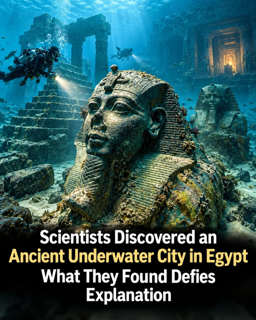
One team of divers has spent around 63,000 hours underwater off the coast of Egypt over 20 years.
Down there, you come across statues lying in the silt.
You come across giant columns stretched out on the seabed.
And it honestly feels like swimming down the streets of a drowned town.
For centuries, Heracleion, the place the ancient Egyptians called Thonis, was treated as nothing more than a legend.
A port that had slipped under the waves where the Nile meets the sea off the coast of modern Alexandria.
It lived on in a handful of rare inscriptions and a few lines in ancient texts until divers finally found it in the early 2000s.
This is Ambrose Wild.
And that rediscovery was only the start of the mystery.
The bigger question is how a busy royal port, packed with temples and ships, could vanish so completely that for centuries people treated it as a legend.
The answer is lying in the mud under the city.
And we’ll get to it.
Abu Qir Bay, on Egypt’s north coast, in the 1990s.
Franck Goddio, a French underwater archaeologist, was leading a team from the European Institute for Underwater Archaeology working with Egypt’s Antiquities Authorities.
Earlier archaeologists had looked for Heracleion on land because nobody imagined a city could be sitting several kilometers out to sea.
Goddio’s team went looking offshore with instruments instead, and the search took 5 years.
They used a nuclear magnetic resonance magnetometer built with France’s Atomic Energy Commission, plus side-scan sonar and sub-bottom profilers that can see through the sand, and they mapped the magnetic field of the seabed one strip at a time.
They needed it because visibility in that bay is sometimes measured in centimeters.
In 1999 they found the neighboring town of Canopus and soon after they found Heracleion about 7 km from today’s shoreline under roughly 6 to 10 m of water and several more meters of sediment.
But finding ruins wasn’t the same as knowing what they were.
Ancient writers mentioned a Thonis and a Heracleion and for a very long time scholars assumed those were two different places.
Then in 2001 the divers lifted a stone slab from the seabed perfectly intact with its inscription still sharp.
It was a royal decree from 380 BC in the reign of the pharaoh Nectanebo the first setting the taxes on goods coming into the port.
1/10 of the import duties went to the temple of the goddess Neith at Sais.
A twin of that slab had been dug up at the trading town of Naukratis back in 1899 and putting the two together settled it.
Thonis was the Egyptian name.
Heracleion was the Greek one and they had always been the same city.
Goddio said the stone solved a 2,000-year-old mystery.
So, what was this place? Think of it as Egypt’s front door.
Before Alexandria existed ships from the Greek world came in through the mouth of the Nile’s Canopic branch, the biggest and most navigable branch in ancient times and Heracleion was where they stopped, paid and got checked.
The Greek historian Herodotus even tells a story about it.
In his version the Trojan prince Paris and Helen landed right here and a watchman named Thonis caught them and sent them on to Memphis to be judged.
The heart of the city was the great temple of Amun-Gereb.
Pharaohs came there to receive the titles that made them kings of the world at least as the priests told it.
In front of that temple the divers found a statue of the Nile God happy in red granite, 5.
4 m tall and weighing about 6 tons, the biggest statue of a god found in Egypt so far.
Every year in the month the Egyptians called Koyak, the priests carried a figure of Osiris in a ceremonial boat from this temple along the canals to his shrine in Canopus, celebrating the god who died and came back to life.
Around the temples, the team found gold coins, bronze and stone weights used by merchants, and dozens of small limestone coffins made for mummified animals left as offerings.
They even turned up bones of oxen, a giraffe and a hippopotamus, enough that the team has wondered whether there was a kind of zoo here.
And then there are the ships.
Around Heracleion lie roughly 70 ancient wrecks, which makes it the largest collection of ancient ships ever found in one place, and some of them are more than 25 m long.
One of them, known as ship 17, turned out to be a Nile boat called a baris, built exactly the way Herodotus described Egyptian boats around 450 BC.
In 2021, the team announced a Ptolemaic galley about 25 m long.
In 2023, the divers went back to the temple of Amun and found its foundation still resting on wooden posts and beams that were remarkably intact.
Inside the treasury area, they recovered silver ritual instruments, gold jewelry, alabaster jars for perfumes and oils, and a little pillar carved from lapis lazuli.
Just east of the temple set a Greek sanctuary to Aphrodite, and nearby lay Greek weapons, a sign that Greek mercenaries once guarded the river mouth for the pharaohs.
Massive blocks from the temple were found tipped into the city’s southern canal, knocked down in some violent event in the middle of the 2nd century BC.
That collapse was an early warning of how this whole city would end.
People like to compare Heracleion with Pompeii, and it fits up to a point.
Both cities were frozen with their everyday lives still in place, one under volcanic ash and one under the sea.
But Goddio’s team says Heracleion is about twice the size of Pompeii, and they think they’ve explored only around 5% of it.
Here is the detail that everyone missed at the time.
Heracleion wasn’t the only royal site that went under.
About 30 km to the west, in the eastern harbor of Alexandria, Goddio’s team found something in 1996 that historians had been placing in the wrong spot for a long time.
It was Antirhodos, a small island described by the Greek geographer Strabo, and it turned up on the opposite side of the harbor from where people had expected it.
On it were the remains of a palace with marble floors, about 90 m long and 30 wide, which many believe was part of Cleopatra’s royal quarter.
Nothing on the site was built later than her dynasty, so the palace seems to have been abandoned soon after her death.
What the divers lifted from around it reads like a family album.
There’s a life-size granite statue of a shaven-headed priest of Isis holding a jar topped with the head of Osiris.
Beside it lay a pair of granite sphinxes, and one of them has the face of Cleopatra’s father, Ptolemy the 12th.
There’s a huge stone head thought to show her son Caesarion.
Facing the island, the team located the site of the Timonium, the retreat Mark Antony started building and never finished.
And Antirhodos probably went under after the great earthquake of the year 365, which struck near Crete and sent a tsunami across the eastern Mediterranean.
But an earthquake on its own doesn’t explain Heracleion.
And we’re coming back to that.
Alexandria itself was the city that replaced Heracleion as Egypt’s door.
Alexander the Great founded it in 331 BC.
And it grew into one of the busiest ports in the ancient world, shipping Egypt’s grain to Rome, where the empire depended on it.
It’s most famous landmark was the lighthouse on the island of Pharos, which ancient writers counted among the seven wonders.
Ptolemy the first ordered it built.
His successor finished it.
And estimates put its height somewhere between 103 and 118 m.
Earthquakes battered it for centuries, the worst in 1303.
And in 1480, a sultan named Qaitbay used its fallen stone to build the fort that still stands on that spot.
Then in 1994, a French team led by Jean-Yves Empereur found the lighthouse’s remains on the harbor floor.
By the end of 1995, they had logged more than 3,300 pieces, including granite blocks weighing 49 to 60 tons each.
Working in that harbor is slow, because salt water eats away at stone and metal.
So, anything brought up has to be treated for years.
And a lot of what Goddio’s team records stays where it lies, in the hope of an underwater museum one day.
Among the statues found in Alexandria’s waters is a giant red granite figure, believed to be Ptolemy the second, a Greek king carved in the full style of a pharaoh, which pretty much sums up the city.
Greek rulers, Egyptian gods, Roman trade, all in one harbor, along with pottery, earrings, and rings.
The daily leftovers of a very rich town.
Alexandria was also the brainy capital of the Greek world.
And some scholars think its influence reached all the way to one of the strangest objects ever pulled from the sea.
In 1901, divers working a Roman era wreck off the Greek island of Antikythera brought up a lump of corroded bronze.
That lump turned out to be a machine.
It survives as 82 fragments with about 30 bronze gears, and it was built to predict eclipses of the sun and moon, track the moon’s uneven orbit, show the positions of the planets, and even count off the cycle of the Olympic Games.
In 2016, researchers reading inscriptions on it describing cycles of 462 and 442 years, the periods of Venus and Saturn.
In 2021, a team at University College London, led by Tony Freeth, published a model of how the whole front display worked.
One of the engineers on that team, Adam Wojcik, admitted that the tiny nested tubes at its core shook his faith in what Greek craftsmen could make.
As he put it, “Unless it’s from outer space, we have to find a way in which the Greeks could have made it”.
Nobody knows who built it.
But with Alexandria’s scholars studying math and mechanics, many think it came out of that world.
That brings us to the far side of the Arabian Sea.
On the western tip of the Saurashtra Peninsula in Gujarat, India, where the Gomti River meets the sea, stands the town of Dwarka.
In Hindu tradition, the original Dwarka was the golden city founded by Lord Krishna, as told in the Mahabharata.
A fortress city surrounded by water and laid out with planned streets, markets, and palaces.
After Krishna left this world, the story goes, the sea swallowed it.
The British writer Graham Hancock, who spent years diving off India’s coasts, puts the drowned ruins there at around 6,000 or 7,000 years underwater, and he admits nobody knows how long they stood before that.
Indian archaeologists have taken the legend seriously enough to go and look.
Marine surveys off Dwarka have turned up stone structures, walls, and steps on the seabed, and some finds have been radiocarbon dated to the second millennium BC.
Between 2005 and 2007, surveys by the Archaeological Survey of India found clusters of submerged remains, including sculptures and stone anchors.
In 2007, a dig near the Dwarkadhish Temple cut through a deposit about 10 m deep with 26 separate layers full of beads, copper, iron, and pottery.
And in 2025, the survey’s underwater wing sent a new nine-person team back out to Dwarka and the island of Bet Dwarka.
One detail from these sites matters for the bigger story.
Hancock makes the point that sites like these went under mostly because the land itself subsided, and only partly because the sea rose.
That one idea turns out to explain Heracleion better than any legend does.
Some people push the idea of drowned cities much further, all the way to Antarctica.
The theory goes like this.
In 1958, Charles Hapgood published The Earth’s Shifting Crust with a foreword by Albert Einstein, arguing that the Earth’s whole outer shell can slide around like the skin on an orange.
If that happened, Antarctica might once have sat in a warmer place, and a lost civilization could have lived there before ending up under the ice.
Hancock picked up related ideas in his 1995 book Fingerprints of the Gods.
Supporters connect it to flood stories around the world and to a real event, the sea rising around 400 ft when the last ice age ended.
The science doesn’t back the shifting crust, though.
Real movement of the poles is measured at about a degree every million years or slower, and the geographic poles haven’t wandered more than about 5 degrees in the last 130 million years.
Antarctica really was green once, which is where people get confused.
In 2017, scientists drilled a sediment core off West Antarctica and found roots, pollen, and spores from a swampy rainforest, published in the journal Nature in 2020.
The average temperature there was about 12° C, and one of the researchers compared it to the forests of New Zealand today.
The catch is the date, about 90 million years ago, back when dinosaurs were alive.
Later, in the Eocene, between about 56 and 34 million years ago, there were still forests of beeches and conifers down there until the continent drifted into isolation and a cold current started circling it and froze it over.
So, Antarctica was lush just tens of millions of years before any human being was around to see it.
What the evidence does show is that people were clever far earlier than we used to think.
On South Africa’s southern coastlines, sits Blombos Cave, excavated by Christopher Henshilwood since the 1990s.
In it, his team found a pigment workshop about 100,000 years old with ochre mixtures stored in abalone shells, along with polished bone tools, more than 70 shell beads strung for wearing, and pieces of ochre engraved with crosshatched lines.
In 2018, they announced the oldest known drawing in the world, nine red lines sketched with an ochre crayon on a small flake of rock about 73,000 years ago.
I mean, think about that for a second.
Somebody sat in that cave and doodled.
Jump forward to South Central Turkey and you get Çatalhöyük, found by James Mellaart in 1958, with Ian Hodder taking over the digging from 1993.
People lived there from about 7,500 to 5,600 BC in mud-brick houses packed so tightly that there were no streets at all.
The rooftops were the streets and you went home by climbing down a ladder through a hole in your roof.
The walls carried paintings of vultures and hunting scenes and one mural may show the twin peaks of Mount Hasan which some call the oldest map ever made though not everyone agrees.
The houses were all about the same size with no palaces which is why many think the town ran without much of a ruling class.
There’s a twist here, too.
Some of the paintings and figurines Mellaart reported may have been made up.
So, yeah, not great for the man who found it.
Then there’s Derinkuyu in central Turkey’s Cappadocia region.
In 1963, a local man renovating his house knocked through a basement wall and found a passage behind it.
That passage led to an entire city carved into the soft volcanic rock going down about 85 m level after level with homes, schools, chapels and tombs.
It could hold up to around 20,000 people with their animals and food.
Huge rolling stone doors could seal each floor from the inside.
Ventilation shafts carried fresh air to the deepest rooms and a tunnel about 8 or 9 km long connects it to another underground town at Kaymakli.
The first rooms were probably cut by the Phrygians around the 8th century BC.
More than 600 entrances have been found.
Some still sitting under people’s homes and no, I’m not making that up.
In northern Spain, the cave of Altamira tells a different kind of story about experts refusing to believe their eyes.
In 1879, an amateur archaeologist named Marcelino Sanz de Sautuola was led into the cave by his 8-year-old daughter Maria and he realized the shapes on the rock above them were paintings of bison.
He argued they were prehistoric.
The leading French experts laughed at him and some accused him of forgery because the ceiling didn’t have soot marks.
It took until 1902 for one of his leading critics, Emile Cartailhac, to publish an article called mea culpa don cheptic, a skeptic’s apology.
By then, Sautuola had been dead for 14 years.
The bison probably date to somewhere between about 14,000 and 16,500 years ago.
But a 2012 study dated a red sign in the cave to about 36,000 years ago.
So people were painting in there across more than 20,000 years.
Ancient people left more than pictures and the written ones are where Egypt’s secrets finally opened up.
In July 1799, during Napoleon’s invasion of Egypt, a French officer named Pierre François Bouchard spotted a dark slab built into the wall of a fort near the town of Rosetta.
It weighed about 760 kg and carried a decree from 196 BC for the King Ptolemy V written three times in hieroglyphs, in the everyday demotic script, and in Greek.
The British took it in 1801 and it’s been on display in the British Museum since 1802.
In September 1822, Jean-François Champollion announced he had cracked the system.
That stone is the key that lets scholars finally read the writing on Egypt’s tombs and temples.
Once those walls could be read, Egypt started talking.
The pyramid texts carved inside royal pyramids around 2400 to 2300 BC are the oldest religious writings we know of from Egypt.
Spells to lift a dead king up to the gods.
Over the centuries, those spells spread into the coffin texts and finally the Book of the Dead written on papyrus so ordinary people could face the judgment of Osiris, too.
The Egyptians wrote down their math as well.
The Rhind Mathematical Papyrus was copied by a scribe named Ahmes around 1,550 BC from an older text and it holds 84 math problems for training scribes.
The Scottish collector Alexander Henry Rhind bought it in Luxor in 1858 and one of its problems works out the area of a circle in a way that gives pi as about 3.
16 off by less than 1%.
Even in the 20th century, Egypt kept giving up texts.
In 1945, near the town of Nag Hammadi, a farmer named Muhammad Ali Samman dug up a sealed jar.
Inside were 12 leather-bound books and part of a 13th, 52 texts in all, written in Coptic in the 3rd and 4th centuries.
What survived includes the Gospel of Thomas with 114 sayings of Jesus and dozens of Gnostic writings that the early church left out, probably buried by a community that wanted to protect them.
Today they sit in the Coptic Museum in Cairo, which brings us back under the water because Heracleion was solved by a text, too.
That slab from 2001 is a stone decree, just like the one from Rosetta, and it gave the city back its two names.
The rest of the puzzle, how the city disappeared, comes from the ground.
Heracleion was built on soft, waterlogged Nile mud packed with clay.
As that mud slowly compacted, the land sank and temples that once stood several meters above the sea ended up with water at their doors within a few hundred years.
Then, around 101 BC, after a severe flood, the ground under the central island gave way in a process called liquefaction.
Under the weight of heavy stone buildings and shaken by floods, earthquakes, or tidal waves, wet clay can stop acting like solid ground and start acting like a liquid.
The city kept going in a reduced form for centuries.
But by the end of the 8th century AD, the last of it had slipped under the sea along with about 110 square kilometers of the Nile Delta.
So, the ancient city that seemed to defy explanation sank because the ground beneath it turned to something like soup.
And with only about 5% of it explored so far, whatever is waiting in the other 95% hasn’t been seen by anyone in more than 1,200 years.
I’m Ambrose Wilde, and when Goddio’s divers bring the next piece of Heracleion up into the light, you’ll hear about it right here along with more discoveries like this one.