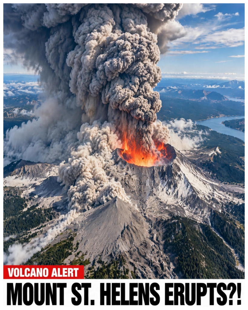
What if one of America’s most infamous
Volcanoes began showing signs of life again?
Mount St.
Helens shocked
The world in 1980 when a massive eruption destroyed forests, buried
Roads, and claimed 57 lives.
Today, scientists continue to monitor this dangerous
Volcano, watching for changes deep beneath the mountain.
Although it is not currently
Showing signs of an imminent major eruption, the possibility of future activity raises serious
Questions.
What would happen if Mount St.
Helens erupted again, and how prepared is America for the
Next disaster?
Join us in this video as we dig in.
The Warning Signs Beneath Mount St.
Helens
Mount St.
Helens has a history of terrifying eruptions, but recently, scientists have
Been paying close attention to the activity happening beneath the volcano.
According to the
U.S.
Geological Survey, around 350 earthquakes were recorded between February and June 2024,
Followed by 12 more between September 2024 and January 2025.
Most were too small for people
To feel, but one earthquake on May 31, 2024, reached magnitude 2.0.
More than 95 percent of
These earthquakes had magnitudes below 1.0.
Still, scientists noticed something unusual.
This was
The largest burst of seismic activity at Mount St.
Helens since its last eruption in 2008.
Naturally, this raised questions about what was happening deep underground.
One possible
Explanation is called magma recharge.
Think of it as a volcano slowly refilling its underground
Supply of molten rock.
As magma rises and enters a storage area beneath the mountain, it
Can put pressure on surrounding rocks, causing small earthquakes.
However, this does not
Automatically mean an eruption is coming.
In fact, Mount St.
Helens experienced similar periods
Of earthquake activity during the late nineteen-eighties and nineteen-nineties
Without producing another major eruption.
Scientists are also watching for other warning
Signs, including changes in the ground’s shape, unusual gas emissions, and rising temperatures.
So far, those additional signs have not appeared, and the volcano remains at normal alert level.
According to the USGS, this kind of earthquake activity can continue for years without leading
To a major eruption.
But if the mountain is slowly refilling beneath the surface, one important
Question remains: how will scientists know when its behavior begins to change?
They definitely
Have their ways.
Could today’s warning signs lead to another disaster like 1980?
And what really
Happened in 1980?
Keep watching to find out.
The 1980 Eruption That Changed
Mount St.
Helens Forever To understand why scientists are watching
Mount St.
Helens so closely today, we need to go back to May 18, 1980.
That morning, one of
The most destructive volcanic events in American history transformed an entire mountain in a
Matter of minutes.
The eruption did not come without warning.
In the weeks leading up to
The disaster, the volcano had already shown several signs that something serious was happening
Beneath the surface.
It began on March 20, 1980, when an earthquake measuring magnitude 4.2 shook
Mount St.
Helens.
At first, the earthquake was only one event in a series of changes that would
Soon become much more alarming.
On March 27, steam began escaping from the volcano, creating visible
Signs of activity.
Over the following weeks, more earthquakes occurred, and scientists began paying
Closer attention to the mountain.
By the end of April, something even more unusual had appeared.
The volcano’s northern side was beginning to bulge outward.
This was not an ordinary change
In the mountain’s shape.
Pressure from rising magma beneath the surface was pushing the ground
Outward, creating a growing bulge.
As the weeks passed, this section of the mountain continued
To expand, suggesting that enormous forces were building inside it.
Then came the morning that
Changed everything.
At 8:32 a.m.
On May 18, another earthquake struck, this time measuring
Magnitude 5.1.
The shaking triggered a massive collapse of the volcano’s northern flank.
An enormous section of the mountain suddenly broke away and rushed downhill in what became
The largest known debris avalanche in recorded history.
But the collapse was only the beginning.
As the northern side of the mountain gave way, pressure inside the volcano was suddenly released.
Instead of producing only a vertical explosion from the summit, the eruption blasted outward
Through the newly exposed side of the mountain.
Hot volcanic material, ash, gas, and rock surged
Across the surrounding landscape.
The resulting pyroclastic flows were so destructive that they
Flattened forests and damaged buildings across approximately 230 square miles, or 600 square
Kilometers.
Imagine standing in a forest where trees have grown for decades, only to see the
Entire landscape swept away by a violent blast of superheated material.
That was the kind of
Destruction Mount St.
Helens unleashed.
The force of the eruption was not limited to the immediate
Area around the crater.
It changed the surrounding environment on a scale that few people had ever
Witnessed.
The eruption also released more than 1.5 million metric tons of sulfur dioxide into
The atmosphere.
On the Volcanic Explosivity Index, a scale used to compare the strength of volcanic
Eruptions, the event was rated a five.
It was classified as a Plinian eruption, a type known
For producing enormous columns of ash and gas that rise high into the atmosphere.
For more than
Nine hours, Mount St.
Helens sent a powerful plume of ash into the sky.
At its highest, the column
Reached approximately 12 to 16 miles above sea level.
Strong winds carried the ash eastward at
Around 60 miles per hour, spreading it across several states.
By midday, ash had reached Idaho.
The following morning, deposits were reported as far away as Edmonton, Alberta, Canada.
For people
Living far from Washington State, the eruption might have seemed like a distant disaster.
Yet the
Ash spread across communities hundreds of miles away, covering cars, roofs, roads, and farmland.
What began as activity inside a single volcano had become an event affecting a much wider region.
The eruption also produced another dangerous phenomenon: lahars, or volcanic mudflows.
When
The northern side of the mountain collapsed, it mixed with ice, snow, and water.
This created
Enormous flows of mud, rocks, and debris that rushed down nearby river valleys.
These mudflows
Traveled along the Toutle and Cowlitz Rivers, destroying bridges, damaging lumber camps, and
Carrying huge quantities of material downstream.
Approximately three million cubic meters of debris
Were transported about 27 kilometers south into the Columbia River.
The mixture of water and
Volcanic material turned rivers into destructive channels capable of sweeping away structures and
Reshaping the landscape.
By around 5:30 p.m., the towering ash column had begun to lose height.
However, smaller explosions and bursts continued through the night and over the following days.
The eruption released an estimated 24 megatons of thermal energy and ejected approximately 2.79
Cubic kilometers of material.
The physical shape of Mount St.
Helens was permanently changed.
The collapse removed roughly 1,300 feet, or 400 meters, from the mountain’s height.
Where
A familiar volcanic peak had once stood, a massive crater now stretched approximately one to two
Miles across.
The northern side of the crater was left open, revealing the enormous damage caused
By the eruption.
But the human and environmental cost was even more devastating.
Fifty-seven
People lost their lives.
Many were caught in areas affected by the blast, falling trees, hot
Volcanic material, and other destructive forces.
Thousands of large animals, including deer, elk,
And bears, were unalived, while an estimated 12 million fish at a hatchery also perished.
More than 200 homes were destroyed or heavily damaged, along with approximately 185 miles
Of highways and 15 miles of railway lines.
For communities near the volcano, the disaster
Meant more than damaged buildings and blocked roads.
It meant lost lives, destroyed livelihoods,
And a landscape that would take years to recover.
Forests that had once covered the surrounding
Hills were replaced by flattened trees, ash-covered ground, and vast fields of volcanic
Debris.
Yet Mount St.
Helens did not become completely quiet after the disaster.
Between 1980
And 1986, the volcano continued to produce smaller explosions and episodes of activity.
A new lava
Dome gradually formed inside the crater as thick, molten rock rose to the surface and cooled.
Unlike
The explosive blast of May 1980, much of this later activity involved lava slowly building
A new structure within the damaged mountain.
This process showed that the volcano was still
Capable of producing new landforms long after its most destructive eruption.
Small explosions
And dome-building episodes continued to reshape the crater, reminding scientists that the mountain
Remained an active volcanic system.
More activity followed during the late nineteen eighties and
Early nineteen nineties.
Between December 7, 1989, and January 6, 1990, and again between November
5, 1990, and February 14, 1991, Mount St.
Helens produced additional eruptive activity, sometimes
Sending clouds of ash into the air.
These events were much smaller than the 1980 disaster, but
They demonstrated that the volcano had not finished changing.
Then, in 2004, the mountain
Entered another important period of activity.
On October 11, magma reached the surface, beginning
A new phase of lava-dome growth.
This time, the lava emerged on the southern side of the existing
Dome inside the crater.
Over the following months, the new dome continued to grow as magma was
Pushed upward from below.
The activity created unusual features that looked almost unreal.
One
Of them was nicknamed the whaleback, a long, solidified mass of magma forced upward by pressure
From the material beneath it.
These formations were not permanent.
As the pressure changed and
The structures became unstable, pieces broke away and tumbled down the dome.
On July 2, 2005,
The tip of the whaleback broke off, producing a rockfall that sent ash and dust hundreds of meters
Into the air.
The event was a reminder that even without a massive explosion, the movement of
Volcanic rock can produce sudden and potentially dangerous changes.
Another notable event occurred
On March 8, 2005, when a plume of steam and ash rose approximately 36,000 feet, or 11 kilometers,
Into the atmosphere.
The plume was visible from Seattle, attracting attention far beyond the
Immediate area.
A magnitude 2.5 earthquake accompanied the activity, which scientists
Interpreted as consistent with the ongoing growth of the lava dome.
As the dome continued to
Develop, another feature emerged.
Known as the fin or slab, this large mass of cooled volcanic
Rock was pushed upward at a reported rate of as much as six feet, or two meters, per day.
By
Mid-June 2006, the structure was breaking apart through frequent rockfalls, although the upward
Movement continued for a time.
The dome itself remained below the height it had reached before
The whaleback collapsed in 2005.
Later that year, on October 22, a magnitude 3.5 earthquake caused
Another section of the lava dome, known as Spine 7, to collapse.
The resulting avalanche sent an
Ash plume approximately 2,000 feet, or 600 meters, above the western edge of the crater.
The cloud
Quickly dissipated, but the event demonstrated how pressure, earthquakes, and unstable volcanic
Structures could work together to produce sudden changes.
In December 2006, a large white plume
Of condensing steam was observed rising from the volcano.
Some media reports suggested
That a small eruption had occurred.
However, the U.S.
Geological Survey’s Cascades Volcano
Observatory did not report a significant ash plume.
Much of the ongoing activity at the
Time involved the gradual extrusion of lava and the continued formation of the dome rather
Than a major explosive event.
By January 2008, steam began escaping through a fracture near
The top of the lava dome.
The accompanying seismic activity was the most significant recorded
Since the latest eruptive period began in 2004.
Scientists temporarily suspended activities inside
The crater and on the mountain’s flanks as a precaution, although they considered the risk of
A major eruption to be low.
By the end of January, the eruption had paused, and no more lava was
Being pushed out to form the dome.
On July 10, 2008, scientists determined that the eruptive
Episode had ended after more than six months without volcanic activity.
The story of
Mount St.
Helens is therefore not simply about one catastrophic morning in 1980.
It is
About a volcano that has repeatedly changed, released pressure, built new structures, and
Entered periods of quiet.
Some episodes have been destructive, while others have involved
Relatively small earthquakes, steam emissions, and slow-growing lava domes.
That history matters
Today because it shows why scientists cannot judge a volcano’s future by one earthquake or one
Period of unusual activity alone.
Mount St.
Helens has experienced both violent eruptions and
Years of much quieter behavior.
Understanding the difference requires careful monitoring and a
Close look at what is happening beneath the surface.
What happened to the people caught in the
Eruption’s deadly path?
Stay tuned to find out.
The Lives Lost and the Human
Cost of the 1980 Disaster When Mount St.
Helens erupted on May 18, 1980, the
Destruction went far beyond the mountain itself.
Forests disappeared beneath powerful blasts,
Roads were buried, and entire landscapes were transformed in a matter of minutes.
But behind
The damage was an even more heartbreaking reality: 57 people lost their lives, and some of their
Stories would become permanently connected to one of America’s worst volcanic disasters.
The
Timing of the eruption may have prevented an even greater tragedy.
May 18 fell on a Sunday, when
Many loggers were not working in the surrounding forests.
Had the eruption occurred on a normal
Working day, when more logging crews were in the area, the death toll could have been considerably
Higher.
Even so, the people who remained near the mountain had little idea of just how devastating
The eruption would become.
One of the most widely known victims was Harry R.
Truman, an 83-year-old
Man who operated the Spirit Lake Lodge.
Truman had lived near Mount St.
Helens since 1929 and
Had developed a deep attachment to the mountain and the lake.
As warnings increased in the weeks
Before the eruption, local authorities repeatedly urged him to leave the area.
He refused, choosing
To remain at his lodge despite the growing danger.
His decision attracted enormous media attention.
Truman became a familiar figure in news reports because of his stubborn determination to
Stay in the place he called home.
However, when the mountain erupted, the area around Spirit
Lake was devastated.
Truman disappeared, and his body was never recovered.
His story remains one of
The most tragic reminders of how difficult it can be to persuade people to abandon places they love,
Even when the danger is real.
Another victim was David A.
Johnston, a 30-year-old volcanologist
Who was studying the mountain from Coldwater Ridge.
Johnston was part of the scientific effort
To monitor Mount St.
Helens and understand the changes taking place before the eruption.
He was
Stationed at a location where he could observe the volcano, but the sudden collapse of its
Northern side unleashed a massive lateral blast that swept through the surrounding area.
Moments
Before the pyroclastic flow struck his position, Johnston sent a radio message that would become
One of the most famous final communications in American volcanic history.
“Vancouver!
Vancouver!
This is it!”
Those were his last recorded words.
Johnston’s body was never found, but his work and
His final message became enduring symbols of the risks scientists sometimes face while studying
Dangerous natural events.
His observations also helped demonstrate how quickly a volcano’s
Behavior can change, even when experts are closely monitoring it.
The eruption also
Claimed the life of Robert Landsburg, a photographer who was documenting the approaching
Disaster.
As the enormous ash cloud advanced, Landsburg continued taking photographs.
When it became clear that the situation was becoming deadly, he placed his camera and
Film inside his backpack and lay on top of it, apparently trying to protect the images from
The destruction.
His body was found on June 4, 1980.
Remarkably, the camera and film had survived
Well enough for the photographs to be recovered.
Those images later provided scientists with
Valuable evidence of the eruption’s development and the approaching ash cloud.
Landsburg’s
Final actions preserved a record that helped people understand the disaster long after it
Was over.
The devastation was so extensive that even those who had never visited Mount St.
Helens
Struggled to imagine what had happened.
On May 22, President Jimmy Carter toured the damaged region
To see the destruction firsthand.
Looking across the devastated landscape, he reportedly remarked
That someone had described the area as resembling a moonscape, but that the moon looked more like
A golf course in comparison.
His words captured the extraordinary scale of the destruction.
The
Danger did not disappear after the first eruption.
On May 23, a film crew led by Seattle filmmaker
Otto Seiber was taken by helicopter into the affected area to document the damage.
Once on the
Mountain, the crew became disoriented, and their compasses began spinning in circles.
A second
Eruption occurred on May 25, adding to the danger.
Fortunately, the crew survived and was rescued two
Days later by National Guard helicopter pilots.
The footage they captured later became part
Of a popular documentary titled The Eruption of Mount St.
Helens!
While the loss of life and
Destruction near the volcano were devastating, the eruption also caused serious economic problems
Hundreds of miles away.
Ash carried by the wind fell across eastern Washington, damaging crops and
Disrupting agricultural activities.
The resulting losses were estimated at approximately 100 million
Dollars at the time, equivalent to hundreds of millions of dollars in today’s money.
Farmers
Faced difficult conditions as ash covered fields, machinery, and crops.
The fine material could
Interfere with equipment and make ordinary farming operations much harder.
Communities that
Depended on agriculture suddenly had to deal with an unexpected disaster that had begun far beyond
Their fields.
Yet the effects of volcanic ash were not entirely negative.
During the 1980 growing
Season, apple and wheat production increased in some areas, possibly because the ash helped
Soil retain moisture.
Scientists have noted this possibility, although the ash was not universally
Beneficial and its effects varied depending on local conditions.
The eruption also created
Unexpected commercial opportunities.
Volcanic ash became a raw material for products such
As helenite, an artificial gemstone made using material associated with the eruption.
It was also
Used in ceramic glazes and sold to tourists as a souvenir of the historic event.
These developments
Revealed the complicated aftermath of a volcanic disaster.
The eruption assassinated people,
Destroyed property, damaged agriculture, and transformed the landscape.
At the same time, the
Recovered photographs helped advance scientific understanding, and the ash eventually found uses
In certain industries.
Still, the stories of Harry Truman, David Johnston, and Robert Landsburg
Show that the most lasting consequences cannot be measured only in money, photographs, or changes to
The landscape.
The eruption took lives, separated families from loved ones, and left communities
Struggling to understand what had happened.
Beyond the human tragedy, what ancient stories
Explain this mountain’s power?
Let’s find out.
The Ancient Legend That Explains Mount St.
Helens
Long before Mount St.
Helens became known for its deadly eruption in 1980, Native American tribes
Had their own stories about the mountain and the powerful forces surrounding it.
For generations,
These stories helped explain the volcanic activity, the changing landscape, and the deep
Spiritual meaning of the mountains in the Pacific Northwest.
One of the most famous is the Klickitat
People’s legend of the Bridge of the Gods, a story of love, jealousy, and a terrible conflict that
Changed the land forever.
According to the legend, the chief of the gods once traveled down the
Columbia River from the Far North with his two sons, Pahto and Wy’east.
They were searching for
A place where they could settle, and eventually, they reached a beautiful region near what is now
Known as The Dalles, in Oregon.
Both sons wanted the land for themselves, so their father decided
To settle the disagreement by shooting two arrows from his powerful bow.
One flew north, while
The other traveled south.
Pahto followed the northern arrow, and Wy’east followed the
Southern one.
To allow his family to meet, the chief built a magnificent bridge across the
River.
It became known as the Bridge of the Gods, connecting the lands where his sons had settled.
For a time, the arrangement seemed to work.
However, everything changed when both brothers
Fell in love with the same beautiful maiden, Loowit.
Neither brother was willing to give
Her up.
Their jealousy grew into a violent battle that destroyed forests, buried villages,
And shook the earth.
As the fighting continued, the mighty bridge collapsed into the Columbia
River, creating the dramatic landscape associated with the Columbia River Gorge.
The chief of
The gods was furious at the destruction caused by his sons.
To punish them, he transformed
The two brothers and Loowit into mountains.
Wy’east became Mount Hood, standing with its head
Lifted proudly toward the sky.
Pahto became Mount Adams, his head lowered toward the woman he
Had loved.
Loowit became Mount St.
Helens, remembered for her beauty and the tragedy that
Surrounded her.
In this legend, Mount St.
Helens was not simply a mountain made of rock.
It was
Connected to a story about powerful emotions, family conflict, and the forces that could reshape
The earth.
The Klickitat name for the mountain, Louwala-Clough, is commonly translated as
“Smoking” or “fire mountain,” reflecting the volcanic activity that made it such a
Striking feature of the region.
Other Native American tribes also hold the mountain in deep
Spiritual regard.
The Cowlitz and Yakama peoples, for example, have their own names and traditions
Associated with it.
The mountain is known as Lawetlat’la, a name roughly translated as “the
Smoker.”
It features in creation stories, songs, and ceremonies, and the area above the tree line
Holds particular spiritual significance.
These connections are more than ancient tales passed
Down for entertainment.
They reflect generations of cultural knowledge and relationships with a
Landscape that has never been completely still.
In recognition of this importance, more than 12,000
Acres around Mount St.
Helens have been listed on the National Register of Historic Places because
Of their cultural significance.
Today, scientists study Mount St.
Helens through earthquakes,
Satellite measurements, and volcanic gases.
Native American traditions offer a different
Perspective, one shaped by history, spirituality, and a long relationship with the land.
Together,
These perspectives remind us that the mountain has meant far more to the people who live around it
Than a potential natural disaster.
What historical eruptions reveal the mountain’s dangerous past
Before 1980?
Keep watching to find out more.
The Forgotten Eruptions That Came Before 1980
Long before Mount St.
Helens became famous for its devastating eruption in 1980, the volcano
Had already attracted attention from explorers, settlers, and people living throughout the
Pacific Northwest.
Its history reveals something important: the mountain had been active for
Centuries, and its periods of quiet did not mean it had lost its power.
The first recorded
European sighting of Mount St.
Helens came on May 19, 1792.
British Royal Navy commander George
Vancouver and the officers aboard HMS Discovery spotted the mountain while surveying the northern
Pacific coast.
Later that year, on October 20, Vancouver gave it the name Mount St.
Helens,
Honoring Alleyne FitzHerbert, a British diplomat who held the title of Baron St.
Helens.
At the
Time, the mountain’s name might have seemed like a simple tribute to a British official.
But the
Land already had a much longer history with the Indigenous peoples who lived around it.
They knew
The mountain through their own names, traditions, and experiences with its volcanic activity.
For
Them, this was not an unfamiliar peak discovered by European explorers.
It was a powerful part
Of their homeland.
In the years that followed, reports began circulating about volcanic
Activity in the region.
Explorers, traders, and missionaries heard stories of eruptions,
Although many accounts were not immediately understood or accurately dated.
Geologists and
Historians later connected these reports to an eruptive period that began around 1800 and
Continued for decades.
This period became known as the Goat Rocks Eruptive Period.
Some of the accounts describe the effects of volcanic ash on nearby communities.
According to one historical report, members of the Nespelem tribe in northeastern
Washington encountered what was described as “dry snow,” believed to have been volcanic ash.
Instead
Of gathering food, the people reportedly responded by dancing and praying, and they suffered from
Starvation during that winter.
The account illustrates how volcanic activity could
Affect people far beyond the mountain itself, especially when ash interfered with everyday life.
A few years later, in late 1805 and early 1806, members of the Lewis and Clark Expedition saw
Mount St.
Helens from the Columbia River.
They did not report an ongoing eruption or clear evidence
Of recent activity at the volcano.
However, they noticed unusual conditions near
The mouth of the Sandy River, including quicksand and channels obstructed by debris.
These observations have been discussed in connection with possible volcanic activity
Elsewhere in the region, including Mount Hood, although they do not establish that Mount St.
Helens had erupted at that time.
As the nineteenth century progressed, the mountain continued to
Attract scientific and public attention.
In 1829, explorer and writer Hall J.
Kelley proposed
Renaming the Cascade Range the President’s Range and giving its major peaks the names of former
American presidents.
Under his proposal, Mount St.
Helens would have become Mount Washington.
The suggested names never replaced the established ones, and Mount St.
Helens kept the name given to
It by George Vancouver.
More direct accounts of volcanic activity began appearing in the eighteen
Thirties.
In March 1835, Meredith Gairdner, who worked for the Hudson’s Bay Company at Fort
Vancouver, recorded what is considered the first authenticated non-Indigenous eyewitness report
Of an eruption at Mount St.
Helens.
He sent his account to the Edinburgh New Philosophical
Journal, where it was published in January 1836.
In 1841, the American Exploring Expedition passed
Along the Pacific coast, and Yale geologist James Dwight Dana observed the mountain from near the
Mouth of the Columbia River.
Another member of the expedition later described volcanic rock
Formations near its base.
These observations helped build the scientific record of a mountain
That was far from dormant throughout its history.
Then came what became known as the Great Eruption
Of 1842.
Not every story from this period can be confirmed.
In 1843, future California governor
Peter H.
Burnett recounted a tale about an Indigenous hunter who supposedly suffered severe
Burns from lava or hot ash and sought treatment at Fort Vancouver.
However, a contemporary official
At the fort denied knowing about the incident.
The story therefore remains doubtful, showing
Why historical reports must be examined carefully rather than accepted as fact.
By April 17,
1857, a newspaper in Steilacoom, Washington, was reporting that Mount St.
Helens, or another
Mountain to the south, appeared to be erupting.
The lack of a significant ash deposit associated
With this report suggests that the event, if it was Mount St.
Helens, was relatively small.
It was the last reported volcanic activity at the mountain before the long quiet period leading up
To 1980.
So what are your thoughts about Mount St.
Helens?
Let us know in the comments section below.
In the end, Mount St.
Helens reminds us that even after decades of silence, nature can surprise
Us when we least expect it.
Like, subscribe, and share this video.
Turn on notifications
For more untold stories.
Thanks for watching!