In the summer of 1988, a man climbed into a clear acrylic sphere, sealed the hatch above his head, and sank into the deepest lake in the United States.
He was alone.
The sphere was about the size of the inside of a small car, one seat, two mechanical arms, a bank of lights, and around him the water went from blue to a deeper blue to a blue that doesn’t really have a name, to black.
It takes a long time to fall nearly 2,000 ft.
And everything anyone knew about this lake said the bottom should be the most boring place in Oregon, cold, still, sterile, a bowl of snowmelt sitting inside a dead volcano, no rivers flowing in, no rivers flowing out, just thousands of years of silence.
That is not what the lights found.
They found something gold, draped over the rocks like wet fabric, and when the instruments pushed into it, the temperature reading jumped, not by a fraction of a degree, by a number that made no sense for the floor of an alpine lake.
Something down there was warm, and something was living on it.
I’d love to tell you that’s the strange part.
It isn’t.
That’s the part where it starts.
Because over the next two summers, and then again 12 years later, the people studying this lake found pools of water lying at the bottom of the water, towers of stone that nobody built, a chemical fingerprint that didn’t come from rain or snow, and eventually an entire hidden landscape, volcanoes and landslides and drowned beaches sitting underneath one of the most photographed views in America.
I’ve been reading the original reports, the dive summaries, the survey data, and I’ll be honest with you.
I went in expecting a pleasant nature story.
I did not expect to come out unable to look at that blue circle the same way again.
Let me show you what I found.
Start with a postcard.
You’ve seen it even if you don’t know you’ve seen it.
An almost perfectly round lake cupped inside a ring of cliffs, a single small island off to one side shaped like a witch’s hat, and the color, a blue so saturated that people who visit for the first time regularly assume the photographs were edited.
They weren’t.
It’s on the Oregon state quarter.
It’s on 100,000 calendars.
Half a million people a year drive up to the rim, step out of the car, and go quiet.
And the facts they’re given at the rim are all true.
It’s the deepest lake in the United States, 1,943 ft.
You could stand One World Trade Center on the bottom, and the tip of the spire would still be underwater.
No river feeds it, no river drains it.
Every drop in that basin fell out of the sky as rain, or as some of the more than 40 ft of snow that lands on this mountain in an average year.
It leaves only by evaporating or by seeping slowly out through the rock.
And because nothing flows in, nothing muddy flows in.
It’s among the clearest large bodies of water ever measured.
Scientists lower a simple black and white disc on a line and note when it disappears.
In most lakes, that happens in a few feet.
Here, the disc has stayed visible more than 130 ft down.
So, that’s the postcard.
Pure, still, blue, a finished thing.
But there’s a question that the postcard never answers.
And once it occurred to me, I couldn’t put it down.
What is at the bottom? Not how deep is it? What is actually down there? I assumed somebody had always known.
It’s a national park.
It’s been one since 1902.
Surely there was a map.
There is a map, a good one.
It’s younger than Google.
And the first human being to actually look at that floor with his own eyes did it within my lifetime.
How does that happen? How does one of the most famous landscapes in the country keep a second landscape hidden underneath it until the year 2000? To understand that, you have to understand what this lake is sitting on top of, or more accurately, what it’s sitting inside of.
Here’s the first thing the postcard leaves out.
When you stand on the rim of Crater Lake, you’re not standing at the top of a mountain.
You’re standing about halfway up one.
The rest of it is missing.
Geologists call it Mount Mazama.
By their reconstructions, it stood somewhere around 12,000 ft tall, a mile higher than the rim you stand on today.
One of the great peaks of the Cascades, glaciers on its flanks, half a million years in the making, and about 7,700 years ago, it destroyed itself.
The eruption was one of the largest anywhere on Earth in the last 10,000 years.
It threw out something like 12 cubic miles of molten rock.
Ash from it has been identified across eight US states and three Canadian provinces.
Traces of it are in the Greenland ice sheet, and when the chamber underneath had emptied, the mountain had nothing left to stand on.
The summit didn’t blow off, it fell in.
The whole upper mile of the volcano collapsed into the void beneath it, leaving a hole 5 miles wide and nearly 4,000 ft deep.
That hole is the postcard.
Now, here’s the part that genuinely stopped me.
People saw it happen.
In 1938, an archaeologist named Luther Cressman was digging in a cave at Fort Rock in the Oregon desert, about 55 miles away.
He dug down through a thick layer of volcanic ash, Mazama ash.
And underneath that layer, he found sandals, dozens of them, woven from sagebrush bark, charred at the edges.
Later dating put them at over 9,000 years old.
People were living in the shadow of that mountain long before it fell.
And the Klamath people, whose ancestors they likely were, never stopped telling the story.
In the Klamath telling, the mountain was the home of Lao, the chief of the below world.
Lao came up through the opening at the summit and stood there, and he fought with Skell, the chief of the above world.
The battle was fire.
Red-hot rocks as big as hills hurtled through the sky.
Burning ash fell like rain.
The people fled to the waters of Klamath Lake.
And at the end, the mountain collapsed on top of Lao and drove him back into the below world.
When morning came, the high mountain was gone.
Rain fell, and the great hole filled with water.
Sit with that for a second.
That’s not a vague flood myth.
That’s an eruption, a collapse, and a caldera filling with rainwater in the correct order, carried by word of mouth for something like 300 generations.
And the Klamath treated the lake accordingly, a place of power, a place you approached carefully if at all, and did not discuss with outsiders.
Which may be part of why American settlers didn’t lay eyes on it until 1853, when a gold prospector’s mule, as the story goes, stopped dead at the edge of a cliff its rider hadn’t seen coming.
So, from the very beginning, this was a lake with something underneath it.
The oldest account we have says so directly.
The thing that made this place didn’t leave.
It was driven down.
>> >> I’m not telling you the story is literally true.
I’m telling you that in 1988, a team of oceanographers named one of the strangest things they found on the lake floor after Lao.
We’ll get there.
So, why did it take so long to look? The honest answer is that this is an absurdly difficult place to study.
The lake sits inside a bowl of cliffs, some of them 2,000 ft high.
There’s no road to the water.
To this day, there is one trail down to the shore.
Everything that floats on Crater Lake had to be carried, lowered, or flown in.
The first people to try were a US Geological Survey party in 1886.
They hauled a half-ton survey boat, the Cleetwood, up the mountain by wagon, and then lowered it down the inside of the caldera wall on ropes.
Their depth-sounding equipment was a spool of piano wire with a piece of lead pipe on the end.
They would row out, let the wire run until it went slack, and read the number.
They did that 168 times.
Their deepest reading was 1,996 ft.
With piano wire and a lead weight, in 1886, they landed within about 50 ft of the modern figure.
It’s a remarkable piece of work.
But 168 soundings is 168 pin pricks across 20 square miles of floor.
You learn that it’s deep in the middle and shallower at the edges, and that’s about all you learn.
In 1959, a government survey crew came back with an echo sounder and ran lines across the lake.
Better.
>> >> Now there were hints.
A large rise in the north, a platform near the island, shapes, but blurry ones, like a photograph taken through frosted glass.
And that’s roughly where things stayed.
We had mapped the near side of the moon in finer detail than the bottom of the most famous lake in Oregon.
Then, in the late ’70s and early ’80s, researchers started noticing that the lake wasn’t behaving.
Here’s what a deep, cold lake is supposed to do.
Freshwater is at its heaviest at about 39° Fahrenheit.
So, in a deep mountain lake, the bottom water settles in right around that temperature and just sits there.
Dense, dark, uniform.
If you lower a thermometer through it, the reading should flatline.
The deeper you go, the less happens.
In Crater Lake, the reading doesn’t flatline.
When researchers lowered sensitive instruments in the early ’80s, they found that in the deepest parts of the lake, the water got very slightly warmer as they approached the floor and very slightly saltier.
Now, I want to be careful here.
This is where a video like this usually says, “And science can’t explain it”.
Science could.
There were two explanations on the table.
Explanation one, this is a volcano.
The rock under the lake is still warm from 7,000 years ago, and that warmth is just slowly soaking upward the way heat comes off a parking lot at night.
Nothing is flowing.
Nothing is venting.
It’s a cooling corpse.
Explanation two, it isn’t just heat coming through the floor, it’s water.
Hot, mineral-laden fluid heated somewhere down in the plumbing of the volcano actively rising and leaking into the bottom of the lake.
Which would mean the system under Crater Lake wasn’t a corpse at all.
Heat flow measurements from the bottom sediments pointed toward explanation two.
In certain patches of the floor, the numbers were far too high.
And this wasn’t just an academic argument.
There was money on it.
In the 1980s, an energy company held geothermal leases on national forest land right outside the park boundary and wanted to drill.
Federal law, meanwhile, was being amended to protect significant thermal features inside national parks.
So, as I understand the history, the question of whether Crater Lake had active hydrothermal vents on its floor suddenly had legal and financial weight.
If the vents were real, the lake was a protected thermal feature, and drilling next door got a great deal harder.
If the warm water was just old rock quietly cooling, it was a different conversation.
The company’s consultants argued for the quiet version.
Congress directed that the question be studied.
So, for one brief window, a lot of people needed to know exactly what was on the floor of this lake, and sensors on a wire weren’t going to settle it.
Somebody had to go and look.
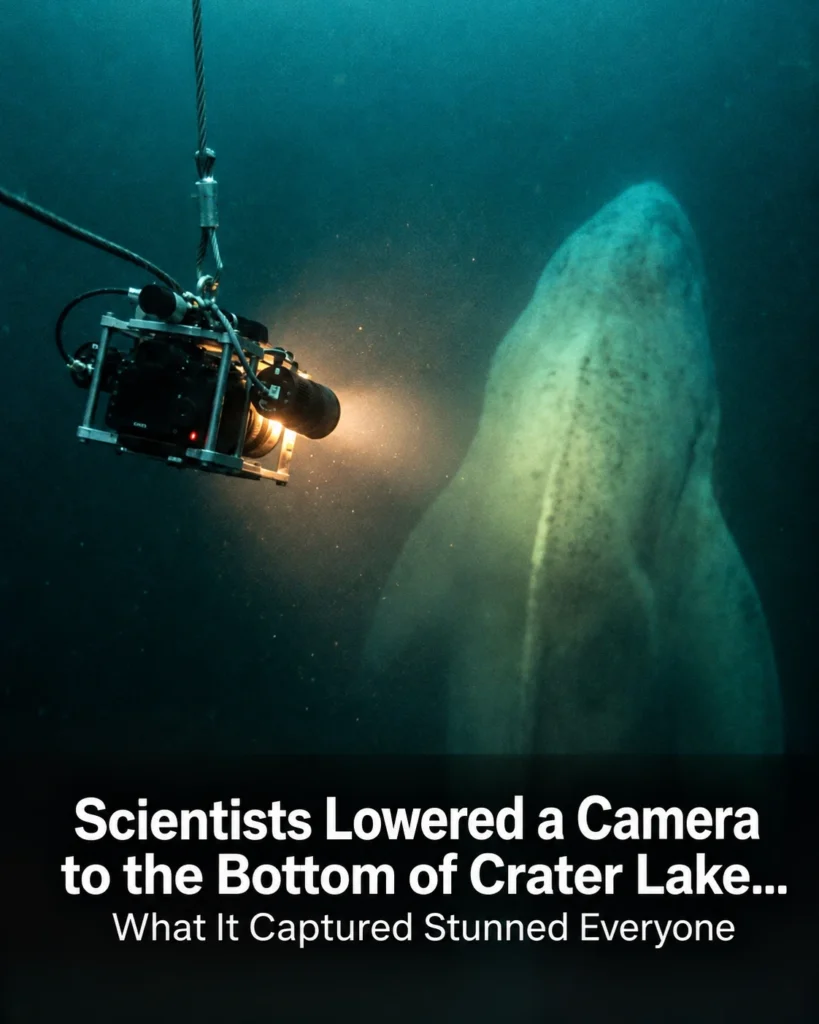
In 1987, a team from Oregon State University, working with the Park Service, lowered a remotely operated vehicle into the lake, a camera on a tether.
This was the reconnaissance.
The first time anything with an eye had been sent toward the deep basin.
What came back up the cable was mostly what you’d expect.
Sediment.
Pale, fine, undisturbed.
Rock.
Darkness at the edge of the lights.
But in the areas where the instruments had flagged warm water, the camera caught something that wasn’t sediment and wasn’t rock.
Patches of color.
On the floor of a lake that was supposed to be a desert.
It was enough.
The next summer, they brought a submarine.
Its name was Deep Rover, a one-person submersible built around a transparent acrylic sphere, so that the pilot sits inside a bubble with a view in nearly every direction.
It was flown to the lake by helicopter, because there was no other way to get it there, and lowered onto the water off Wizard Island.
Over the summers of 1988 and 1989, it made 47 dives.
Think about what that was like.
You drop through the most transparent water on the continent, blue in every direction, nothing to give you scale.
Then the light fades.
Then it’s gone.
And for the rest of the descent, you are a small lit bubble falling through black water inside a volcano, toward a place no human being has ever seen.
And then the floor comes up into the lights.
On some of those dives, at the base of the underwater cliffs in the south-central part of the lake, the pilots came across the mats.
They were yellow-orange.
Gold under the lights.
In places just a dusting over the rocks, in places thick and billowing, draped down slopes and gathered in hollows, some of them many feet across.
They looked soft.
They looked, frankly, like something that had no business being there.
The scientists pushed a temperature probe into one.
The water around the submarine was about 38° Fahrenheit.
Inside the mats, the team reported readings as high as the mid-60s.
Nearly 30° warmer than the lake across a distance you could span with your hand.
When they brought samples up and put them under a microscope, the mats turned out to be bacteria.
Vast colonies of them building tiny sheaths and stalks coated in iron.
And these weren’t organisms living off sunlight filtering down from above.
There is no sunlight at that depth.
They were living off chemistry.
Warm fluid seeping out of the floor carried dissolved iron.
Where that fluid met the oxygen-rich lake water, the bacteria sat right on the boundary and harvested the energy of the reaction.
They were, in effect, eating rust as it formed.
It’s the same trick that powers the vent communities of the deep ocean.
Life that doesn’t need the sun.
Life that runs on the planet itself.
And it was sitting at the bottom of a lake on a postcard.
The findings were published in Nature, one of the most selective scientific journals in the world, in 1989.
The title is as dry as you’d expect.
Bacterial mats from Crater Lake, Oregon and their relationship to possible deep lake hydrothermal venting.
Possible.
Even then, they were careful.
But the mats were only the first thing.
I need you to picture something that sounds impossible.
You’re in the submarine on the floor in the dark.
Your lights sweep across a field of those gold mats.
And in the middle of them, in a hollow in the rock, there is a pool.
A pool of water.
At the bottom of the water.
It has a surface.
It has a shoreline.
The pilots could see the edge of it.
A shimmering boundary where the pool stopped and the lake began.
The way you can see the line between oil and vinegar.
The water inside it was a cloudy, milky blue.
The gold mats grew right up to its rim like moss around a garden pond.
They found more than one.
And they named the most striking of them Yaos Bath, >> [snorts] >> after the chief of the below world, the one who was driven down under the mountain.
I don’t think the scientists were being mystical.
I think they were being affectionate.
But when I read that name in a technical report between tables of chemical concentrations, the hair on my arm stood up.
Here’s what the pools actually are.
The fluid coming out of the floor is loaded with dissolved salts, many times the load of the lake above it.
That makes it dense.
So, even though it’s warm, which ought to make it rise, it doesn’t.
It runs downhill, finds the low spots, and settles.
A brine pool, like the ones on the floor of the Gulf of Mexico.
A lake inside a lake with its own surface holding itself apart.
And remember that odd signal from the early ’80s? Bottom water slightly too warm and slightly too salty? This was it.
This was the source.
These pools and seeps slowly overflowing, slowly bleeding warm salty water into the deepest layer of Crater Lake.
In fact, when the researchers ran the numbers, they concluded something I still find hard to get my head around.
Most of the dissolved salts in Crater Lake, the faint mineral content of all that famously pure water, don’t come from rain or from the cliffs.
They come from below, from the floor.
The purest lake in America is being quietly seasoned by its own volcano.
So, warm ground, gold mats of bacteria living on chemistry, pools of heavy blue water.
Any one of these would have been the find of the expedition.
And then, in 1989, on the east side of the lake, the lights hit something vertical.
This is the part I can’t stop thinking about.
And it’s the part almost nobody seems to know.
The east side of Crater Lake, below a headland called Skell Head, named, of course, for the chief of the above world.
Deep Rover is working along the floor there in an area away from the warm mats when something rises out of the dark in front of the sphere.
A column.
Not a boulder, not a ledge.
A free-standing tower rising straight up off the lake floor.
And then another one behind it.
A cluster of them.
The report describes them as spires.
And it gives a height.
More than 10 m.
That’s over 30 ft.
A three-story building standing in the dark alone at the bottom of a lake.
Now, put yourself in that seat.
Alone in a plastic bubble inside a volcano and your lights have just landed on a group of towers that, in that first second, look made.
Let me be clear.
Nobody built them.
There’s no lost city under Crater Lake.
But, this is the exact moment where a less careful storyteller cuts to a thumbnail with a red circle on it.
The real explanation is, I think, better.
When the team sampled the spires, they were rich in silica.
The same material as quartz, as glass.
And their shape and chemistry matched something oceanographers had seen before.
Hydrothermal chimneys.
When hot mineral-saturated fluid jets out of a vent into cold water, the minerals come out of solution almost instantly.
They precipitate right at the mouth of the vent.
The deposit builds a rim.
The rim becomes a tube.
The tube grows upward year after year with the hot fluid flowing up through its hollow core until you have a tower.
On the ocean floor, the famous versions belch black, metal-rich smoke.
These weren’t smoking.
They were cold, dead.
The report calls them inactive.
But, think about what they mean.
To build a 30-ft chimney out of dissolved silica, you need fluid that’s considerably hotter than the lukewarm seeps feeding those bacterial mats, and it has to have happened underwater, which means it happened after the lake had filled, after the collapse, after the rain, >> >> after the blue.
So, at some point in the last few thousand years, while this lake looked from above exactly the way it looks today, serene and still and finished, there were hot vents on its floor vigorous enough to raise towers three stories tall.
And then they stopped.
When? We don’t really know.
Why? We don’t really know.
Are there more of them out in the dark beyond where 47 dives happened to look? Hold onto that question.
It comes back.
With each report I opened, I kept expecting the strangeness to level off, to find the page where it all settles back into an ordinary lake.
It kept going the other way.
The deeper the researchers looked, the less ordinary the lake became, because after the things they could see came the things they could only measure.
And the water itself, it turns out, was carrying a signature.
Start with helium.
There are two kinds that matter here, ordinary helium-4, which is made slowly inside rocks everywhere, and helium-3, which is different.
Most of the helium-3 on this planet is primordial.
It was locked inside the Earth when the Earth formed 4.
5 billion years ago, and it has been leaking out of the deep interior ever since.
It’s so distinctive that oceanographers use it like a dye tracer.
If you find water enriched in helium-3, that water has been in contact with something that came from a very long way down.
The deep water of Crater Lake is enriched in helium-3.
Then there’s radon.
Radon is radioactive, and it doesn’t last.
Half of any given amount is gone in under 4 days.
So, radon is a clock.
If you find a pool of water at the bottom of a lake with high levels of radon in it, that water can’t have been sitting there long.
It arrived recently.
It came out of the rock days ago.
Which means whatever is feeding those pools wasn’t something that happened once in the distant past.
It was happening while the submarine was parked next to it.
Then, manganese, a metal that hot water strips out of volcanic rock at concentrations enormously higher than in the lake above.
And then the one that, for me, is the quietest and the eeriest.
Carbon.
You’ve heard of carbon dating.
Carbon 14 is made in the upper atmosphere.
It mixes into everything alive and everything in contact with the air, and then it decays away on a schedule.
After 50,000 years or so, it’s effectively gone.
Carbon that has been buried for millions of years, carbon that comes up out of magma has none left at all.
Geochemists have a name for it.
They call it dead carbon.
When the team measured the carbon dissolved in the deep water and in the pools, the radiocarbon was depleted, diluted.
The water looked, by that measure, far older than it could possibly be.
The explanation the researchers gave is that carbon dioxide from the magmatic system below is bubbling dead carbon into the bottom of the lake and mixing with the living carbon from the sky.
So, think about what’s actually in that water.
The water in the postcard.
Helium from the formation of the planet.
Radon that’s only days out of the rock.
Metals leached from the roots of a volcano.
And carbon so ancient it’s gone silent.
None of it visible.
All of it real.
All of it rising quietly into the bluest lake in America.
Yao, the story says, was driven back down into the below world, and the hole was filled with water.
Nobody ever said he stopped breathing.
I have to pause the science for a few minutes, because there’s one more character in the story of those 1988 dives, and he isn’t a scientist.
He isn’t even alive.
He’s a log.
If you take the boat tour on Crater Lake, at some point the ranger will point to something sticking up out of the water.
It looks like a bleached fence post.
It’s the top of a mountain hemlock, about 30 ft long and 2 ft thick, and it is floating perfectly upright.
About 4 ft of it stands above the surface.
The rest hangs straight down into the blue.
It’s buoyant enough that people have stood on top of it.
It’s called the old man of the lake, and the first written record of him dates to 1896.
That’s not a typo.
A geologist named Joseph Diller described a vertical floating log on Crater Lake in the 1890s.
Five years later, he noted that it had moved a quarter of a mile.
It has been bobbing around that lake, upright, ever since.
More than 125 years.
Carbon dating suggests the tree itself is over 450 years old.
Logs don’t do this.
Logs float on their sides, get waterlogged, and sink.
The best guess is that the old man slid into the lake in a landslide with rocks tangled in his roots, which weighted the bottom end down.
The rocks are long gone, but by then the submerged end had soaked up enough water to stay heavy, while the top, drying in the sun, stayed light.
And the cold clean water has preserved the wood like a museum case.
And he travels.
In 1938, park naturalists tracked him for 3 months.
In that time, he covered more than 60 mi, wandering back and forth across the lake on the wind.
On one day alone, he moved nearly 4 mi.
Which brings us to August 1988.
You’ve got a one-person submarine surfacing and diving off Wizard Island, and support boats moving around it, sometimes in poor light.
And somewhere out on the lake there is a 30-ft battering ram, mostly underwater, drifting wherever it pleases at several miles a day.
It’s a genuine navigation hazard.
So, the team did the sensible thing.
They found the old man, towed him to the east side of Wizard Island, and tied him up.
Here’s the story as the park tells it.
The weather had been clear.
Almost as soon as the old man was tied down, it turned.
Clouds came in over the rim.
A storm settled on the lake.
Some versions of the story say it snowed in August.
And so, the scientists, the same people measuring helium isotopes to the decimal point, went back out and untied the log, and the weather cleared.
Now, I know what that is.
Mountain weather turns fast, and human beings are pattern-finding machines.
It’s folklore.
The Park Service tells it with a wink.
But, I find something oddly moving in it anyway, because for thousands of years, the people who knew this lake best said it was a place you don’t disturb lightly.
And in the one summer when outsiders finally went all the way to the bottom, they tied down the lake’s oldest resident, the sky went dark, and a team of hard-nosed oceanographers decided, just to be on the safe side, to let him go.
He’s still out there, still upright, still wandering, still, as far as anyone can tell, in charge of the weather.
One more discovery from below, and this one isn’t volcanic at all.
It’s the opposite.
It’s gentle, and it might be the most beautiful thing in the lake.
Remember the clarity.
Sunlight reaches depths in Crater Lake that it simply doesn’t reach in other lakes.
And it turns out that something has been using that light.
When researchers ran remote vehicles and camera sleds along the underwater walls of the caldera, they found moss.
Not a little moss, a band of it wrapping the inside of the volcano, starting around 80 ft down and continuing to something like 460 ft.
>> >> Think about that figure.
There are very few places on Earth where a green plant grows that far below the surface of anything.
On the steep walls, it hangs in thick curtains, swaying bright green in the lights.
On the gentler slopes around Wizard Island, it lies in deep beds, and it grows on top of itself.
The living layer sits on the dead layer, which sits on an older dead layer in cold water where almost nothing rots.
In places, researchers found the accumulation beneath the living moss goes back thousands of years.
A hanging garden inside a volcano that no human being had seen until the late 20th century.
Growing in silence the entire time people stood on the rim above it, looking at the blue, thinking the lake was empty.
And every one of these discoveries was made through a keyhole, a lone submarine with a cone of light a few dozen feet across.
47 dives on a floor of 20 square miles.
Nobody had yet seen the whole thing.
That took until the summer of 2000, and it took another helicopter.
In July of 2000, a US Army Chinook, one of those huge twin rotor helicopters, lifted a survey boat off the rim of Crater Lake, carried it out over the cliffs, and set it down on the water.
Bolted to that boat was a multi-beam sonar, not the single ping of 1959, a fan of sound sweeping a wide stripe of the floor with every pulse.
For days the boat ran back and forth across the lake in overlapping lines like someone mowing a lawn.
The project was led by the US Geological Survey with university and park service partners.
In 1886, there had been 168 soundings.
In 2000, there were more than 16 million.
And when those 16 million points were assembled and the water was digitally drained away, the floor of Crater Lake appeared on a screen for the first time.
Every feature resolved down to a couple of meters.
I’d seen the postcard a thousand times.
I thought I knew this place, and I sat there looking at something I had never seen in my life.
It is not a bowl.
It is not a smooth basin.
It is a landscape.
Wizard Island, that charming little witch’s hat, it’s the tip of something enormous.
The island you see is the top few hundred feet of a volcano that rises well over 2,000 feet from the lake floor.
It’s a mountain.
We just happen to see its hat.
East of it is a broad lobed platform of lava flows, stacked like spilled wax with channels and levees still crisp on their surfaces.
In the north of the lake, sitting all by itself, is Merriam Cone, a nearly perfect volcanic cone, well over a thousand feet high, with its summit almost 500 feet below the surface.
It appears to have grown entirely underwater.
An entire volcano the size of a skyscraper that, in all of human history, not one person standing on that rim ever knew was there.
Near the center is a dome of lava that erupted roughly 4,800 years ago.
As far as anyone knows, that’s the most recent eruption at Crater Lake.
It happened underwater.
The Egyptians were building pyramids, and around the edges, the map shows the scars of violence.
Great fans of landslide debris where sections of the caldera wall have let go and run out for a mile or more across the floor.
Blocks the size of buildings scattered at their toes.
And then, maybe my favorite detail of all, part way up the flanks of those drowned volcanoes, the sonar picked out faint horizontal benches, terraces.
They’re shorelines.
Old beaches cut by waves from when the lake was only partly full.
Because here’s what the geologist worked out from this map.
The caldera didn’t fill and then go quiet.
The volcanoes on the floor were erupting while the The was rising around them over the course of several centuries.
Lava flowed into water.
The water climbed.
The lava built higher.
The water climbed again.
And at each pause, the waves carved a beach into the side of a volcano, and then the lake rose over it and sealed it in the dark.
A lost world.
Eruption, collapse, rebirth, and then slow drowning.
One shoreline at a time until all of it, every cone and flow and beach, was under 2,000 ft of the clearest water on Earth.
And then the surface went still.
And we put it on a quarter.
Once you’ve seen that map, you cannot unsee it.
I’ve tried.
Every photograph of Crater Lake I look at now, I see the blue, and then a half second later, I see what’s under the blue.
The mountain range nobody mentions.
So, here’s the question I started with.
Why don’t people know this? In the genre of video you may be expecting, this is where I tell you it was hidden, that someone didn’t want you to see it.
I looked.
I don’t think that’s what happened, and I’m not going to pretend otherwise.
As far as I can tell, the real reasons are more ordinary, and in a way more frustrating.
The findings were published, but in places the public doesn’t read.
A letter in nature, a thick university technical report, geological bulletins, a government data release.
The argument over geothermal drilling faded, and the urgency faded with it.
The submarine went home, and the national park has every reason to keep telling the simple story, the postcard story, because the simple story is true, and it fits on a sign.
The knowledge wasn’t buried, it was filed, which I’ve come to think works nearly as well.
And there’s one loose thread that genuinely bothers me, the footage.
Deep Rover carried cameras.
So did the 1987 vehicle.
There is video shot in the late ’80s of the gold mats, the blue pools, the spires below Skell Head.
A few clips and stills have surfaced over the years in old documentaries and on park and institute pages, but the great bulk of it, I can’t find it.
And I’m not the only one looking.
There are threads online, some of them from just this past year, from people who’ve gone down the same rabbit hole and ended up asking the same thing.
Is there more? Where is it? Has anybody seen it? I suspect the answer is aging videotape in a university archive waiting for someone with a budget and a reason.
Not sinister, but a small tragedy.
The only moving images ever taken by a human being on the floor of America’s deepest lake, and almost nobody alive has watched them.
And there are questions the footage couldn’t answer even if we had it.
The spires.
When were they built? What shut them off? Are there others out in the dark that no light has ever touched? The pools.
Are they still there? Is Yao’s Bath the same size it was in 1989? Bigger? Gone? Because here’s the thing that really stays with me.
As far as I can find, no crude submersible has been back to the floor of Crater Lake since 1989.
The sonar gave us the shape of everything, but the number of people who have actually looked at that floor with their own eyes, you could seat at a dinner table, and between them, they saw a sliver of it.
And the lake itself is changing.
Scientists have been monitoring Crater Lake continuously since the early ’80s, and the surface is warming.
That matters more than it sounds.
The deep water only gets refreshed when winter chills the surface enough for it to sink and stir the whole lake.
Some researchers have modeled what happens as winters warm, and their projection is that this deep mixing could become much rarer.
If that happens, the bottom of the lake becomes more isolated.
The warm, salty, mineral-laden water seeping from the floor has nowhere to go.
It just accumulates.
What does that do to the mats? To the pools? To the chemistry of the deep basin? Nobody knows.
Nobody’s down there watching.
And underneath all of it sits the simplest question.
The US Geological Survey doesn’t classify this as an extinct volcano.
They classify it as an active volcanic system and they monitor it.
Mazama has erupted many times over 400,000 years.
The last time was only 4,800 years ago.
In the life of a volcano, that was this morning.
The warm water on the floor is how we know the fire didn’t go out.
It was just driven down.
I keep coming back to that pilot.
Alone in a clear sphere in the dark at the bottom of a volcano.
His lights landing on something gold.
I think about how long that floor waited.
The chimneys rising with nobody to see them and going cold with nobody to notice.
The moss laying down one quiet layer after another.
The beaches sitting drowned on the sides of mountains no one knew were there.
And above it all, the whole time, the blue.
Calm.
Perfect.
Giving nothing away.
People stood on that rim for a century and a half and thought they were looking at a finished story.
A postcard.
And the Klamath, who’d been there for the first chapter, had been saying all along that something was still down there.
They were right.
Not in the way a geochemist would phrase it, but they were right.
I’m not asking you to believe anything.
Everything I’ve told you is in the record.
The sources are below and I’d encourage you to read them.
They’re stranger in the original than I’ve managed to make them here.
What I’m asking is smaller than that.
The next time you see that picture, and you will, on a calendar, on a screensaver, on a quarter at the bottom of your pocket, give it one extra second.
Look at the blue, and then look through it.
Picture the mountain under the island, the cone in the north that never reached the air, the towers below Skell Head standing in the dark, the pool with Yao’s name on it, and ask yourself the question I can’t shake.
If this was hiding under the most photographed lake in America, what’s under all the ones nobody’s bothered to look at? If you know something about those 1988 dives, if you’ve seen the footage, if you worked on the survey, or if there’s a lake near you with a story the postcard leaves out, tell me in the comments.
I read them.
And I have a feeling this isn’t the last time we go down.
I’ll see you in the next one.