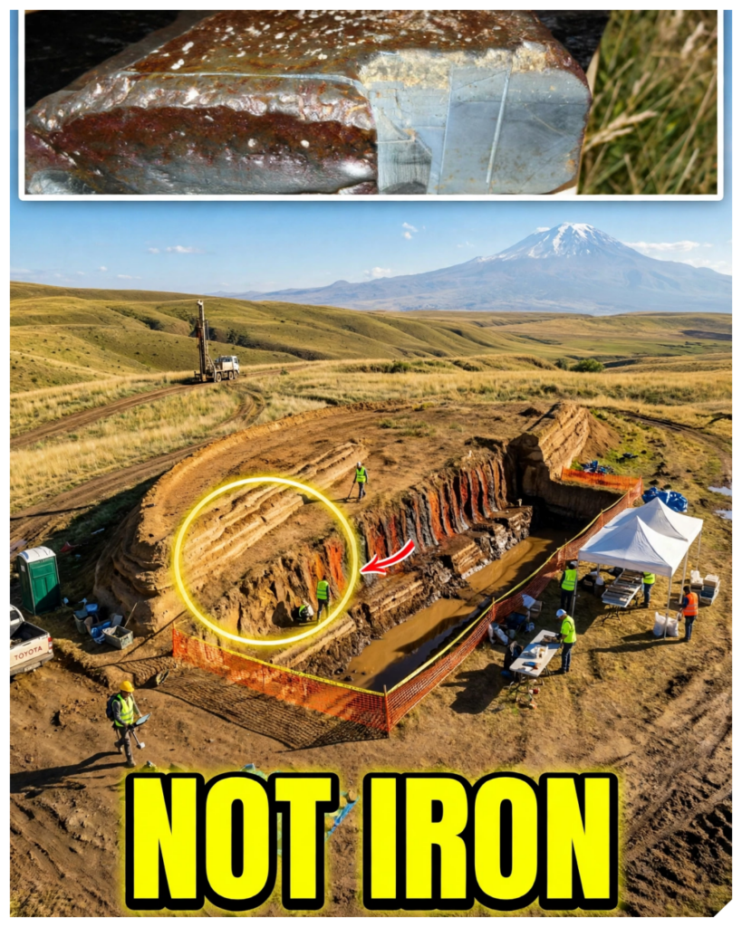
29 kilometers south of Mount Ararat, a drill rig stands on a hill shaped like a ship.
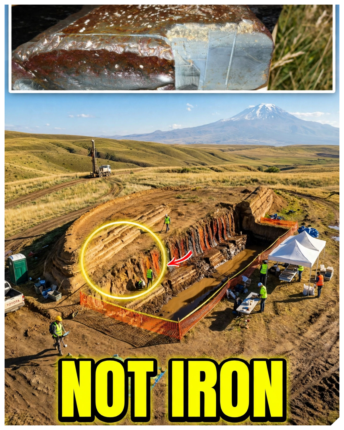
This year, a team board more than 60 feet into it.
They lowered a small robot camera called the Gopher down one of the holes.
Near the town of Dogubayazit, a road sign still points the way to Noah’s ship.
And in laboratories in Ankara, hundreds of soil samples are waiting to be tested.
Yet, before this year’s drilling even began, a headline had already declared the ark real.
Let me be straight with you before we go any further.
No laboratory results from this year have been released.
The geologist who cut this hill’s rocks into thin slices reached his verdict almost 30 years ago.
And some of the people who agree with him believe the flood really happened.
So, what is this strange hill on the mountain actually made of?
The hill sits near a small Kurdish village called Uzenili.
It lies close to the border with Iran, about 2,000 m above sea level.
Mount Ararat rises to the north.
Stand on the ridge above and look down and you see it at once.
A long smooth mound of earth, one end pointed, one end rounded.
A raised rim runs all the way around the edge.
It looks like the hull of a ship sitting in a sea of mud.
Nobody who sees it forgets it.
How long is it?
That depends on who you ask.
Wikipedia gives 164 m.
The team that drilled there this year uses 157.
7 m may not sound like much.
Keep that small difference in mind.
It will matter later when someone tries to match this hill to an ancient measurement.
According to local accounts, the shape first appeared in May 1948.
Heavy rain and earthquakes loosened the mud on the slope.
The ground around the mound washed away, and a Kurdish shepherd looking out over the valley noticed something that had not been there before.
A boat-shaped outline in the earth.
For the people living nearby, it was a curiosity.
For the rest of the world, it did not yet exist.
That changed in 1959.
A Turkish army captain named Ilhan Durupinar was studying aerial photographs.
They had been taken for a NATO mapping survey of the region.
Most of those pictures showed nothing but mountains and valleys and roads, but one of them showed a long pointed shape on a hillside south of Ararat.
The captain saw it and could not let it go.
The site carries his name to this day, Durupin.
Now, here’s the part of the story that almost nobody tells.
The first serious test of this hill happened more than 60 years ago, and it gave an answer.
In September 1960, a team climbed up to the site.
Captain Durupav went with them.
So did Arthur Brandenburgger, a professor who specialized in measuring the ground from aerial photographs.
If anyone could judge a shape seen from the air, it was him.
They spent two days on the mound.
And they did not just walk around it.
They used dynamite to blast open the inside of the shape.
Picture that moment.
If there was a ship buried in that hill, the explosion should have exposed it.
Timber, planks, anything shaped by human hands.
The smoke cleared and the teen looked into the hole.
They found soil.
They found rocks.
And that was all.
No timber, no iron, no sign that anyone had ever built anything there.
Their statement afterwards was clear.
There were no visible archaeological remains.
The formation, they said, was a freak of nature.
It was not made by man.
The men who went up there wanting to know the truth had tested the hill in the most direct way possible, and the hill had answered.
That should have ended it.
It didn’t because the picture was already out.
In its issue of the 5th of September 1960, Life magazine had published the aerial photograph.
Millions of readers across America opened the pages and saw that long pointed shape on the side of a Turkish mountain.
The caption called it Noah’s Ark.
The dynamite came after the photograph.
And the photograph traveled much further than the verdict ever did.
Think about how that works.
A picture is easy to share.
A shape that looks like a ship needs no explanation.
A report that says soil and rocks is easy to forget.
One image had gone around the world before the men with dynamite had even climbed down the mountain.
The legend had a head start and the evidence never caught up.
And one of the people who saw that photograph would spend the rest of his life on that hill.
His name was Ron Wyatt.
He was a nurse anistthetist from Tennessee.
He had no training in geology and no training in archaeology.
What he had was conviction.
From 1977 onward, Wyatt traveled to the hill again and again, and every time he came back, he was more certain than before.
He said the rock on the mound was petrified gopher wood.
That is the wood Genesis names for the ark.
He said he had found rusted iron brackets with a metal detector.
Wherever his detectors buzzed, he and others laid yellow ribbons across the top of the mound.
The ribbons formed lines.
The lines crossed, and Wyatt said those lines were the walls of rooms inside the ship.
To find some of those lines, he used a device he called a molecular frequency generator.
Remember that name.
Other scientists would have a lot to say about it.
Wyatt also wanted proof from a laboratory.
He sent samples to Galbreth Laboratories in Knoxville.
The results came back as a list of elements.
Wyatt read that list as proof of metal inside the hill.
Hold on to that lab report.
A geologist would later take it apart line by line and the idea was taking hold beyond one man.
Turkish authorities protected the area as a park.
A visitor center was built facing the mound.
Today, a road sign near the town of Dogub Bayazit still points the way.
Nuhun Giy, Noah’s ship.
But Wyatt was not alone.
And the next man to study this hill would end up doing something no ark hunter had ever done.
His name was David Fold.
He was a merchant marine officer and a salvage expert.
He knew ships better than most.
He knew how wrecks looked on the seabed.
He began working at the site in 1985 and he made nine trips in total.
He built the most serious case anyone has ever made for this hill.
Remember his name.
His story takes a turn nobody expected.
Fold started with the size.
Genesis describes an ark 300 cubits long and 50 cubits wide.
Fold argued that the hill matched those numbers, but only if you used one particular ruler, the long Egyptian cubit.
Then came the metal.
Fold said metal detector surveys had found more than 5,000 buried iron targets.
They were not scattered at random.
He said they ran in a pattern from one end of the mound to the other, like the iron fittings that hold a wooden ship together.
Then came the radar.
Fold ran his own ground penetrating radar across the hill.
The images seemed to show a regular structure inside lines, angles, something that looked built.
But the strongest piece of evidence was still to come.
In 1985, a physicist from Los Alamos named John Bombgardner recovered what looked like an iron fitting from the site.
This was not a nurse with ribbons.
This was a trained scientist on American television.
In that same year, he said there was considerable evidence it was not a natural object.
For believers, that was a moment of triumph.
And there was more.
About 24 km away in and around the village now called Kazan, there are huge flat stones.
Older maps call the place Arzap.
Each stone weighs between 4 and 10 tons.
Each has a hole cut through one end.
Some are carved with crosses.
Facel and Wyatt and others believed these were drogue stones, heavy anchors that hung from the ark on ropes to keep it steady in the waves.
So by the early 1990s, here is what the case rested on.
A boatshaped hill, a length that matched metal readings in lines, a possible iron fitting, radar patterns, and giant stones with rope holes.
On the surface, it sounds like a lot.
Now watch what happened when each of those pieces was tested one at a time by the believer himself.
After 9 years, David Fold began to feel uneasy.
In September 1994, he went back to the site with the Australian geologist Ian Plymer and he came away convinced of something he had spent years arguing against.
The formation was not a boat.
So he did what a careful man does.
He went back to the evidence that had convinced him most, the iron fitting.
His first step was to ask a simple question.
Was it really made by human hands?
That is where a geology professor named Lawrence Collins enters the story.
Collins taught at California State University, Northridge.
In 1996, he and Fold published their findings together in the journal of geocscience education.
The title did not hedge.
It called the Turkish ark bogus and exposed it as a common geologic structure.
Think about that.
The most important paper ever written against this hill carries the name of the man who championed it.
Now, here is what they found piece by piece.
Start with the iron fitting, the star exhibit.
Under the microscope, it was not forged iron at all.
It was made of grains of lmonite, a rusty iron mineral.
Those grains were packed in a mix of clay and quartz and calsite.
Collins saw the problem.
Iron smelted in a furnace does not come out mixed with clay and quartz and calite.
Those minerals would have been separated out as slag.
He tested its chemistry in five spots.
The chemistry changed from spot to spot.
Smelted metal comes out evenly mixed.
This did not.
The fitting that had made believers cheer was a lump of natural rock.
Then the metal readings, thousands of them.
Collins explained the supposed walls as natural bands of two iron minerals called lmonite and magnetite.
They sat inside steeply tilted layers of rock.
And magnetite along with its rusty cousin goethite makes a metal detector buzz just like real iron.
Years later, Collins added one more detail.
Rainwater washes tiny grains of magnetite into the cracks of the rock.
There they collect and rust.
So a detector that follows the cracks traces lines, even lines that cross.
They are real lines.
They are just not walls.
Now go back to that lab report from Knoxville, the one Wyatt read as proof of metal.
Collins wrote that Wyatt had made an assumption.
He took the list of elements to mean actual metals.
But those elements in those amounts are exactly what you find in volcanic basaltt and in magnetite.
The report said nothing about a ship.
It described the rocks of the mountain.
Then came the test that mattered most to believers.
The wood samples had been taken from what were said to be ribs and planking and deck beams.
All of them turned out to be andite or basaltt, the kind of stones that mud flows carry down a mountainside.
There was no sign of petrified wood.
Even the supposed bark of gopherwood was a crinkled metamorphic rock.
And then the line that matters most.
In all the trenching and drilling done up to that point, no fossil wood had ever been found.
No trace of carbon from wood, not even a fragment of reed, which left one last piece, the anchor stones, with their crosses.
Collins cut a thin slice from one of them.
It was andesite, a volcanic rock of the kind found all around Ararat.
Mesopotamia, where the ark is usually thought to have been built, has almost no volcanic rock at all.
Stones weighing several tons and made of local rock were likely cut nearby.
The crosses are generally thought to have been carved much later in Byzantine or crusader times.
And the archaeologist David Merling along with the Armenian scholar Abraham Tyrion argued the stones were most likely ancient standing monuments, not anchors from a ship.
So if it is not a ship, what shaped this hill so perfectly into a boat?
Let me be honest with you here.
The answer to that question has changed over the years.
That is how science is supposed to work.
In 1996, Collins thought the hill was a sincline.
Picture layers of rock lying flat like the pages of a book.
Now imagine the earth squeezing them until they fold downward into a long trough, a canoe shape made of stone.
Then erosion wore the top away.
And what was left behind looked like the hull of a boat.
Later, Collins revised that idea.
In his updated view, something more dramatic happened.
A landslide of mud and debris came pouring down the slope.
In its path stood a hard plug of old volcanic basaltt.
The debris split and flowed around it.
As it did, it carved the softer layers into a streamlined shape, pointed at the obstacle, rounded at the downhill end, like water flowing around a rock in a stream and leaving a teardrop of sand behind it.
Andrew Jones disputes this.
He argues that a natural obstacle would leave the pointed end facing downhill.
In Collins’s model, the obstacle sits up slope.
Geologists can argue about which process did the most work.
But notice what both sides of that argument have in common.
Neither of them is describing a recovered hull.
And Collins noticed one more thing.
A band of limestone cuts across part of the formation.
That limestone is full of fossils.
Many young earth creationists say fossils like these were laid down by Noah’s flood itself.
If that were true, then this ark-shaped rock would have to be older than the flood that was supposed to have floated it.
The hill cannot be both.
Now, you might be thinking, of course, a secular geologist would say all this.
So, here is the part that surprises people.
Some of the strongest critics of this site believe the flood really happened.
Andrew Snelling is a young earth creationist geologist.
He concluded it was an entirely natural formation.
Writing in Creation magazine in 1992, he went after Wyatt’s molecular frequency generator.
He said it was a gadget advertised in treasure hunting magazines and not in scientific journals.
And he said it worked with brass welding rods used as divining rods.
John Morris of the Institute for Creation Research holds a doctorate in geological engineering.
He surveyed the site twice.
His conclusion was that the hill could be explained by geology.
He compared Wyatt’s device to divination, a practice he said scripture firmly condemns.
And remember John Bombgardner, the Los Alamos physicist who said the fitting looked man-made.
He later tried to repeat Wyatt’s metal lines using an ordinary metal detector.
He could not sit with that for a moment.
Men who believe in the flood looked hard at this hill and they said it was not the ark.
Then came the most recent verdict and it came from Turkey itself.
Dr.
Ezra Atabe is a geological engineer at the country’s general directorate of mineral research and exploration.
On the 30th of May 2025 he visited the site.
That June he posted a paper online.
It was not a peer-reviewed journal article, but his reading was clear.
A sincline folded by the pressure of the earth’s crust and then shaped into its present form by a landslide.
His conclusion in Turkish was blunt.
It is a geological formation, nothing more.
And what about David Fold?
In April 1997, he gave evidence under oath in an Australian court case.
Asked about the claim that the ark had been found, he dismissed it in crude terms.
Yet, his biographer, June Daw, later wrote that he stayed convinced it was the fossilized remains of Noah’s ark.
The two accounts conflict.
Both are on the record.
So, for decades, the physical tests found no timber and no worked metal, and the case moved somewhere much harder to check.
That place was radar.
And to understand where this story starts to run ahead of the evidence, you need to understand what radar can and cannot do.
Ground penetrating radar sends pulses of energy down into the earth.
Then it records what bounces back.
A wall can reflect those pulses.
So can an empty room, but so can a wet layer of clay.
So can a crack.
So can a boulder.
So can the place where one kind of sediment meets another.
Radar does not tell you what something is.
It tells you where something changes and then someone has to interpret the picture.
Keep that in mind.
Every big claim you are about to hear is an interpretation.
Radar was run across Durupanar in 1987.
In October 2019, an American team ran it again.
Their report described distinct geometric patterns between 3 and 7 m below the surface.
But that report was posted on the project’s own website.
It was never published in a scientific journal.
6 years later, the patterns grew into rooms.
In May 2025, Andrew Jones told reporters the radar showed angular structures about 6 m down.
He described a tunnel around 13 m long running through the middle of the hill.
He has been described as the founder of Noah’s Ark Scans.
The group’s website speaks of straight lines and right angles of chambers, rooms, corridors, a tunnel.
So why was one geologist so sure there were no rooms at all?
Because Lawrence Collins had already looked at radar images published by the project in 2020.
He gave a very different reading.
The hill, he said, contains hard masses of volcanic rock and soft layers of mud.
Drilling had already shown a white layer of limestone running straight through the formation and out the other side.
In the radar images, the soft layers look like rooms or the walls of rooms.
The dense rock shows up dark.
His conclusion was firm.
There is no possibility of real empty spaces or rooms beneath the surface.
Jones and his team disagree, and it is a real disagreement.
It is an argument about how to read signals in the ground.
It is not an argument about an object anyone has pulled out of that hill.
Then in August 2026 came a new instrument and with it the boldest claim yet.
A press release announced a survey using a system called Bactar Radar.
It was run by an engineer named Dr.
Kosro Baktar working together with Jones.
The release said the scans did not show the formation as one simple mass of rock.
It said there was no clear boundary underneath.
The news site that reported it noted something important.
The work had not been detailed in peer-reviewed research.
About 6 weeks later, Noah’s Arc scans posted on social media.
The post said, “Dr.
Btar’s preliminary report confirms the formation is not geological.”
In a video, Dr.
Bactar said he was 100% sure the signals came from one original object.
And then he said something else.
He said he did not know what that object was.
A ship, a spacecraft, or something else entirely.
Pause on that.
The man whose radar was used to announce that this hill is not geology does not know what he found.
100% sure of an object.
No idea what the object is.
So what could that single object be?
Nobody outside the team can say.
The interpretation has not been checked by anyone independent.
But nothing in those statements rules out the most obvious candidate of all, the formation itself.
A mixed body of mud and volcanic rock and cracks could also send back connected signals.
That is a possibility and not a finding, but it is where the rest of the evidence points.
Radar was one place the story ran ahead.
The numbers were another.
Start with the measurement everyone quotes.
Genesis gives the ark a length of 300 cubits.
You will often hear that this hill matches it exactly.
But a cubit is the length of a forearm and forearms vary.
The match only works with the long Egyptian royal cubit of about 52 cm.
Use a common cubit of about 45 cm and 300 cubits comes to roughly 135 m.
Now remember the hills two different lengths.
When you can choose both the ruler and the measurement, a match is easy to find.
It just does not prove very much.
Then the soil.
In late 2022, a Turkish university team took about 30 rock and soil samples.
In October 2023, preliminary results put them at roughly 3 to 5,000 years old.
They contained clay and marine material.
To many people, that sounded like the time of Noah, but the professor who announced it, Farukqa, said plainly that dating alone could not prove the ship was there.
Soil on a hillside can be thousands of years old without anything man-made in it.
Then the organic matter.
Noah’s Arc Scans says soil from inside the formation had about three times more organic material than soil from outside.
Popular Mechanics reported the carbon level as roughly 40% higher.
Three times and 40% are very different numbers.
One may be measuring organic material and the other carbon.
Neither has been published with its methods.
And to its credit, the group’s own website admits this does not by itself confirm a wooden vessel.
And that brings us to this year’s drill.
The 2026 season was led by a professor from Civas Jumhuryat University working with Noah’s Arc Scans.
Jones says the drill went more than 60 ft down.
He says they never hit a solid block of limestone or any other rock, mainly soil.
The group says its gopher camera hit no bedrock.
That is a fair point to raise.
So, here is a fair answer.
Boulders did turn up in some holes, and neither leading explanation describes one solid block of stone.
Collins describes landslide debris shaped around a hard core.
At describes folded layers moved by a landslide.
Loose soil and scattered boulders fit both.
Drilling 60 ft and finding no solid rock is not the same as finding a ship.
The drill turned up something else.
Pottery.
Its age has not been determined.
And according to reports, none of it came from inside the formation.
But people have lived in the shadow of Ararat for thousands of years.
Their pottery tells us about them.
It does not tell us what the mound is.
So where do things stand?
Reports even disagree on how many samples were taken.
366 in some, close to a thousand in others.
They are now in laboratories in Ankura to be tested over the winter.
No date has been given for results.
Jones himself put it carefully.
A step forward, not completed.
So why did so many people hear something different?
Compare the dates.
On the 22nd of June, when the permit was announced, a British tabloid headline already called the ark real.
In the same story, the group’s fundraiser called it confirmation.
No core had yet been drilled.
Then at the end of September came the post with the word confirms.
The confirmation came before the evidence.
There is money around this story.
The group raises funds and offers tours and a shop.
That is normal for private expeditions, but it means the people announcing results are raising money from them.
And there is something older than money, a hope more than 2,000 years old.
Collins put it kindly.
Eagerness to find the ark can override caution.
Neither proves anyone’s motive.
Both are reasons the word confirmed should wait for the laboratory.
So come back to the hill at dusk.
The drill rig is gone.
The road sign still points to Noah’s ship.
In Ankura, the sample bags wait on a shelf.
The men with dynamite called it a freak of nature.
The believer who championed it called it bogus.
Creationist geologists called it natural.
Turkeykey’s own geologists called it a formation.
Nothing more.
A fold of mud and volcanic rock and limestone shaped by a landslide.
That is what this hill actually is.
And the oldest texts never pointed here.
Genesis speaks of the mountains of Ararat, a whole region.
The Quran names a mountain called Aljudi.
Neither names this mound.
If the labs find real wood, it will deserve a second look.
Until then, the record is plain.
From the dynamite of 1960 to the drill of this year, the ground has not given up a single plank.